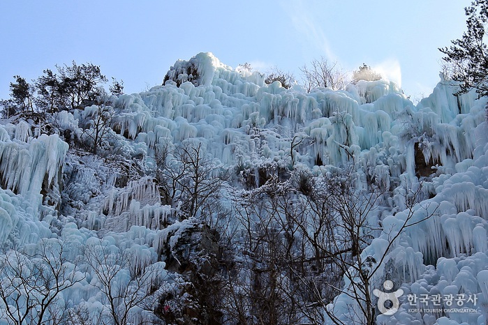
Cheongsong Eoreumgol Valley (Cheongsong National Geopark) (청송 얼음골 (청송 국가지질공원))
486.3M 2024-11-20
1 Naeryong-ri, Juwangsan-myeon, Cheongsong-gun, Gyeongsangbuk-do
Cheongsong Eoreumgol Valley is a gorge located on Juwangsan Mountain in Cheongsong. It is known for its warm winters and cool breezes in the summer, creating a mystical atmosphere. In May 2017, it was recognized for its geological value and certified as a UNESCO Global Geopark. During the summer, when the temperature exceeds 32 degrees Celsius, ice forms in the valley, melting when the temperature drops below 32 degrees Celsius. The area boasts impressive rock formations and stunning landscapes, attracting many tourists with its springs, and artificial falls.
![Jusanji Pond [National Geopark] (주산지 (청송 국가지질공원))](http://tong.visitkorea.or.kr/cms/resource/84/2616884_image2_1.jpg)
Jusanji Pond [National Geopark] (주산지 (청송 국가지질공원))
5.9Km 2025-03-15
Jusanji-ri, Cheongsong-gun, Gyeongsangbuk-do
+82-54-870-6111
Jusanji Pond is a small reservoir located in Juwangsan National Park. It is a man-made pond that was dug out in August, 1720 and completed in October the year after. The pond has been used as a source of water for agricultural use as well as for drinking water. Even though it is small in size, about 200 meters long and 8 meters deep, the pond has never dried up from any drought.
150-year-old willow trees are rooted in the pond, which makes a fantastic balance with the surroundings, creating a picturesque scenery found nowhere else.

Jeolgolgyegok Valley [National Geopark] (절골협곡 (청송 국가지질공원))
8.1Km 2025-01-14
San 124, Jusanji-ri, Cheongsong-gun, Gyeongsangbuk-do
+82-54-870-6111
Jeolgolgyegok Valley is located along the mountain ridgeline connecting Gamebong Peak and Wanggeoam Rock in Juwangsan Mountain. It stretches for 5 kilometers from Jeolgol Valley Visitor's Center to Daemun Bridge. The valley is formed of vocanic tuffs that were welded and compacted after cooling down, which resulted in forming vertical cracks, leaving rocks to fall out and create a steep valley cliff.
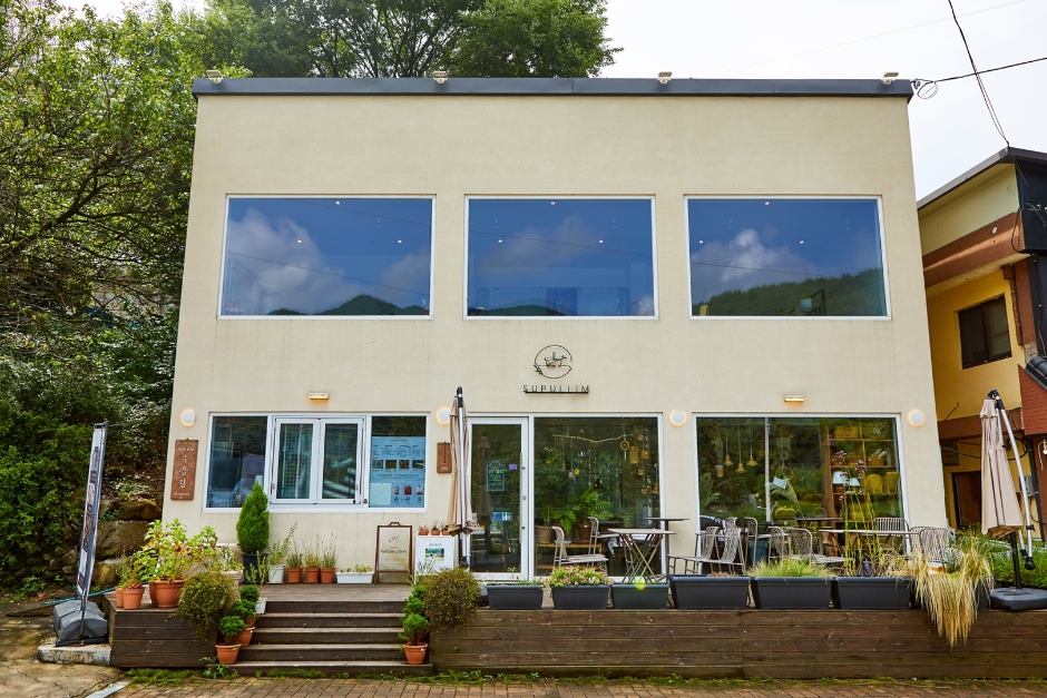
Supullim (수풀림)
11.0Km 2024-12-10
This café is located at the entrance of Juwangsan National Park and is also famous for its Juwangsan Mountain view. The view of Juwangsan Mountain is even better from the second floor. The signature menus here are handmade ssanghwacha (medicinal herb tea) and injeolmi patbingsu (shaved Ice with red beans and injeolmi). The café is a great place to stop by to enjoy the scenery of Juwangsan Mountain before or after the hike. This place also operates as a rattan workshop, showcasing and selling handmade rattan items.
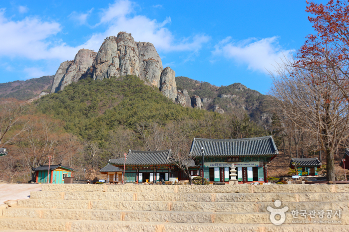
Bogyungsa Temple (보경사)
11.1Km 2020-02-11
523, Bogyeong-ro, Buk-gu, Pohang-si, Gyeongsangbuk-do
Bogyeongsa Temple in Pohang, Gyeongsangbuk-do rest with Jungnamsan Mountain in the background, surrounded by the peaks of Naeyeonsan Mountain. The temple grounds boast 12 beautiful waterfalls flowing from Naeyeonsan Mountain and a picturesque landscape. The temple was built in 602 during the Silla period and also has 4 smaller temples on the grounds.
Naeyeonsan Bogyeongsa Municipal Park (내연산보경사시립공원)
11.1Km 2025-01-08
533 Bogyeong-ro, Songna-myeon, Buk-gu, Pohang-si, Gyeongsangbuk-do
82-54-270-5566
Naeyeonsan Bogyeongsa Municipal Park is a scenic area that encompasses both the historic Bogyeongsa Temple and the majestic Naeyeonsan Mountain. The mountain, rising to a x_height of 710 meters, is renowned for its stunning natural beauty, characterized by twelve waterfalls cascading through a 14-kilometer-long valley. These waterfalls, coupled with towering rock walls ranging from 50 to 100 meters in x_height, such as Sinseondae Cliff and Haksodae Cliff, along with unique rock formations, create a breathtaking landscape. On the southern side of the mountain lies Bogyeongsa Temple, a significant religious site with origins dating back to the Silla period. The temple complex includes attached hermitages like Seounam Hermitage and Munsuam Hermitage. Notably, the temple houses treasured artifacts, including the stele and stupa of State Preceptor Wonjin.
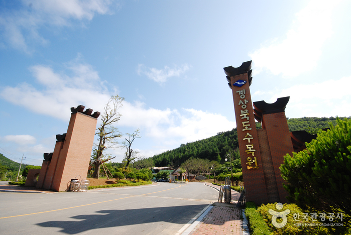
Gyeongsangbuk-do Arboretum (경상북도수목원)
11.2Km 2021-07-26
647, Sumogwon-ro, Jukjang-myeon, Buk-gu, Pohang-si, Gyeongsangbuk-do
+82-54-262-6100
The Gyeongsangbuk-do Arboretum was founded in September 17, 2001. The arboretum exhibits local plants from Ulleungdo, an island off Korea’s eastern coast that is home to a special ecosystem that includes rare trees and wildflowers. The arboretum has total of 24 gardens, including the Alpine Botanical Garden, Ulleungdo Native Plant Garden and Needle-leaf Tree Garden.
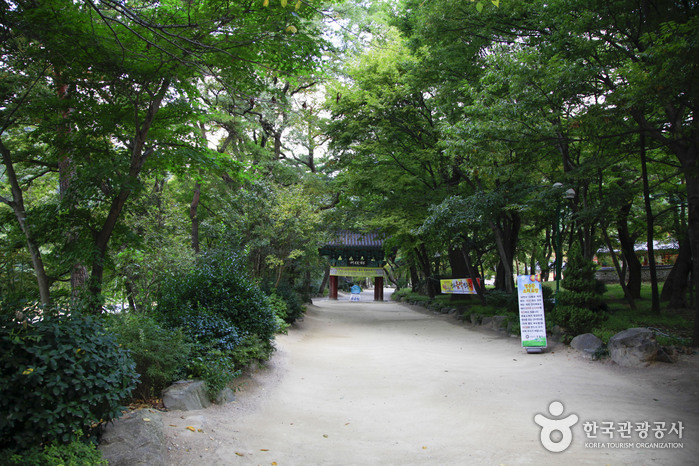
Juwangsan National Park (주왕산국립공원)
11.2Km 2023-03-13
169-7, Gongwon-gil, Cheongsong-gun, Gyeongsangbuk-do
+82-54-870-5300
Juwangsan Mountain (alt. 720.6 m) is located in the Baekdudaegan Mountain Range, the backbone of the Korean peninsula. The mountain features deep valleys and many sheer rock cliffs to make it the third-largest rocky mountain in the country. Juwangsan Mountain was recognized as a tourist attraction on May 30, 1972, and became the 12th national park a few years later on March 30, 1976. The park is relatively small, filling in an area of just 105.582 ㎢ but it is great for a leisure walk with walking trails along the valleys up to waterfalls.
Juwangsan Mountain was called Seokbyeongsan Mountain during the Silla dynasty due to the many stone peaks jutting out but has been called Juwangsan Mountain since the Unified Silla period. In addition to these tall rocky peaks, Juwangsan National Park also includes four waterfalls, caves, Daejeonsa Temple, and other attractions for a comprehensive tourist site.
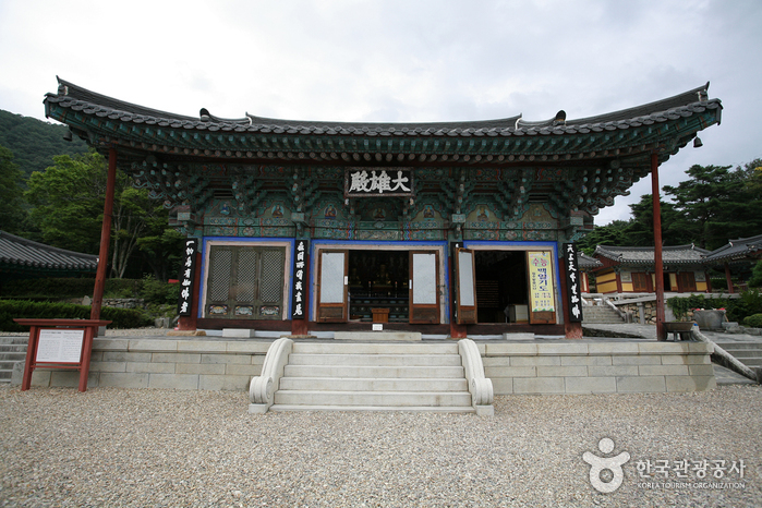
Daejeonsa Temple (대전사)
11.2Km 2023-04-17
226, Gongwon-gil, Cheongsong-gun, Gyeongsangbuk-do
+82-54-873-2908
Daejeonsa Temple is said to have been built by Great Monk Uisang in the 12th year of King Munmu’s reign (672). It was rebuilt in the 13th year of King Hyeonjong’s reign (1672) after a fire destroyed the original temple complex during the Imjin War (1592-1598). During work to renovate Bogwangjeon Hall in 1976, a text that had been put up with the ridge beams was found. Bogwangjeon Hall is a small building and its ceiling is in the shape of a Chinese character that symbolize with the meaning "well" or "pavilion" that looks similar to the sharp(#) symbol. A Birojanabul Buddhist statue is enshrined in the hall.
Three Falls of Juwangsan Mountain (주왕산 1.2.3 폭포)
11.5Km 2024-02-13
24 Sangui-ri, Juwangsan-myeon, Cheongsong-gun, Gyeongsangbuk-do
Above Haksodae Cliff in Juwangsan Mountain lie three enchanting waterfalls. The first of these falls goes by the name of Yongchupokpo Falls, where water gracefully meanders through a gorge, enveloped by encircling rocks. Roughly one kilometer further upstream, you'll encounter Jeolgupokpo Falls, accompanied by the tranquil Seonnyeotang Pond below. To the left of Jeolgupokpo Falls stands the grandeur of Yongyeonpokpo Falls, the largest and most magnificent among them. Yongyeonpokpo Falls is also famously referred to as Ssangyongchupokpo Falls, denoting its two distinct torrents of water ('ssang' meaning 'two,' and 'yongchu' signifying 'pond' in Korean). A well-maintained trekking path welcomes visitors, allowing them to explore and ascend to witness these three falls, with a gentle incline that is easily traversed by visitors of all ages.
 English
 한국어
한국어 日本語
日本語 中文(简体)
 Deutsch
 Français
 Español
 Русский