Seoraksan Gwongeumseong Fortress (설악산 권금성)
10.6Km 2024-02-28
1091 Seoraksan-ro, Sokcho-si, Gangwon-do
Gwongeumseong Fortress is a stone castle from the Goryeo dynasty and is located 800 meters above sea level in Seoraksan National Park. From a distance, Gwongeumseong Fortress looks like a rising peak, while up close, the expansive stone floor and remnants of castle walls become visible. Visitors can access the fortress via hiking trails or by taking a cable car. From the fortress, visitors can enjoy the majestic view of Seoraksan Mountain and the blue waters of the East Sea.

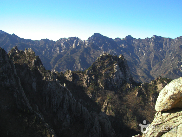
Seoraksan National Park (Outer Seorak) (설악산 국립공원 (외설악))
10.7Km 2024-04-08
1 Daecheongbong-gil, Yangyang-gun, Gangwon-do
Seoraksan Mountain is renowed for its natural splendors and breathtaking views. It holds the distinction of being Korea's first UNESCO Biosphere Reserve and is also listed on the IUCN Green List. The mountain is divided into Inner Seorak, South Seorak, and Outer Seorak, which includes Daecheongbong peak (1,708 meters above sea level), ranking as the third highest peak in Korea. The area is celebrated for its popular hiking trails, with the sunrise and sunset views from the top being particularly spectacular.
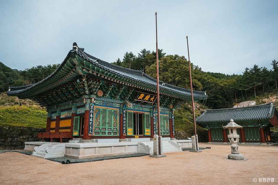
Goseong Hwaamsa Temple (화암사(고성))
10.9Km 2025-12-16
100 Hwaamsa-gil, Toseong-myeon, Goseong-gun, Gangwon-do
Hwaamsa Temple was built during the Silla period, and then repaired many times throughout history, with the temple even moving locations to where it is now in 1864. The current structures were built in 1991 for the World Jamboree. The temple name also changed throughout history, with the current name being given in 1912. The temple is located in a pristine natural environment, and is home to a traditional tea house, making it a great place to relax and feel at peace.
◎ Travel Information to Discover Hallyu’s Charm - Variety Show "Summer Vacation"
Hwaamsa Temple is where actors Jung Yu-mi and Choi Woo-shik participated in a Templestay program on tvN's variety show "Summer Vacation." The two enjoyed a healing retreat through various temple activities, such as morning prayers and tea talks with Buddhist monks, finding peace of mind away from their daily routines. This tranquil temple is recommended as a special destination to rest your body and mind in nature’s embrace.
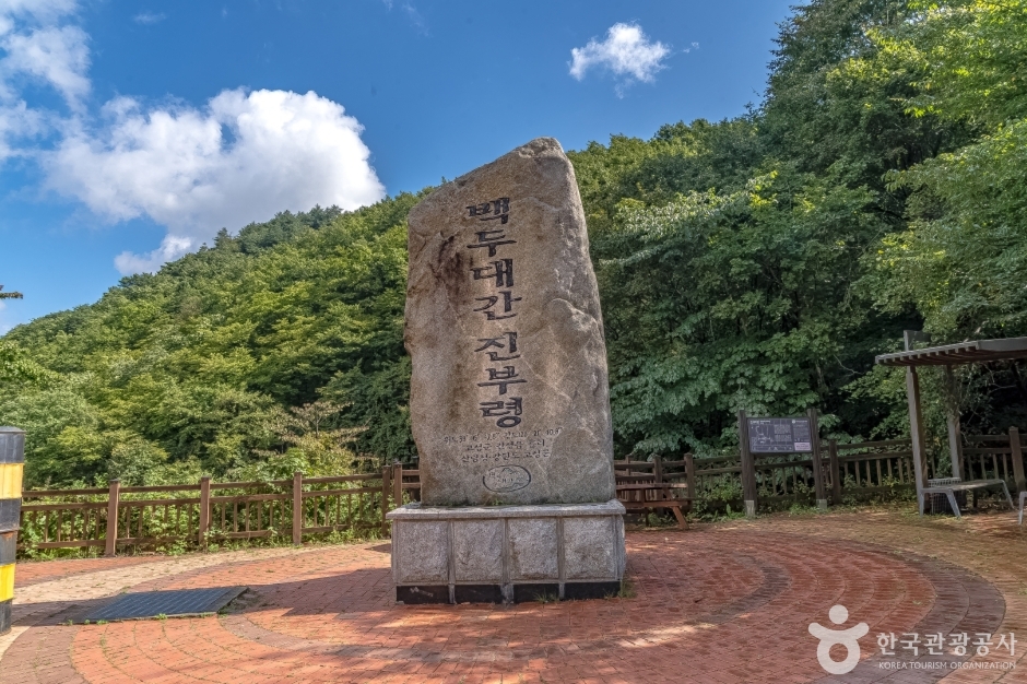
Jinburyeong Heulli Village (진부령 흘리마을)
11.1Km 2025-01-17
185 Heulli-gil, Ganseong-eup, Goseong-gun, Gangwon-do
Jinburyeong Heulli Village, situated near Jinburyeong Pass, is known for its long winters, lasting up for half a year. As a result, the village cultivates highland crops such as chicory and bell peppers and operates pollack-drying fields. Visitors can purchase locally produced wild vegetables, corn, potatoes, medicinal herbs, and honey, or participate in a bell pepper-picking experience. The village is also popular for its local dishes, especially those featuring chicken.
Osaek Green Yard Hotel (오색탄산온천)
11.3Km 2023-10-27
34 Daecheongbong-gil, Seo-myeon, Yangyang-gun, Gangwon-do
Osaek Green Yard Hotel offers Holon Immunity Wellness, a health experience that focuses on Holon immunity, wellbeing, happiness, and fitness. The hotel is located in a forest at an altitude of 647 m, perfect for rest and relaxation. The hotel also uses natural mineral water with a 21.5-23% higher concentration of oxygen for speedy recovery. Guests can enjoy the view of Seoraksan National Park from their rooms.
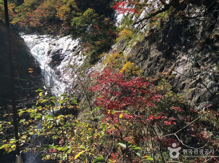
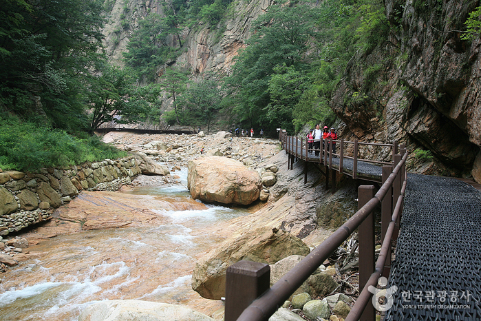
Yukdampokpo Falls (육담폭포)
11.4Km 2021-07-14
Seoraksan-ro, Sokcho-si, Gangwon-do
If you begin at Seorak-dong in Oeseorak, cross the Biryonggyo Bridge and pass by the Biryongpokpo Falls, you will reach Yukdampokpo Falls, which actually consist of six waterfalls and a pond.
Despite the fact that only a small amount of water actually flows in these waterfalls today, what is interesting, is how they came into existence: a slow-flowing stream of water eroded the rocks, creating dips and puddles at various levels, which later became a series of cascading waterfalls. The splendid scenery around the waterfalls is always a pleasing sight to the eyes of visitors.
Seoraksan Osaek Jujeongol Valley (설악산 오색주전골)
11.4Km 2024-02-29
Yaksu-gil, Seo-myeon, Yangyang-gun, Gangwon-do
Osaek Jujeongol Valley in Seoraksan Mountain is renowned for its vibrant autumn maple leaves. The area features a 7-kilometer trail stretching from Oksaek Mineral Spring to Yongsopokpo Falls, accessible to all visitors. The valley boasts stunning scenery, with a mix of valleys and rock formations. When the autumn leaves begin to change colors, the landscape turns into a breathtaking masterpiece.
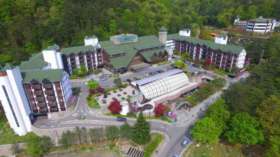
Osaek Greenyard Hotel (오색그린야드호텔)
11.4Km 2025-10-23
34 Daecheongbong-gil, Seo-myeon, Yangyang-gun, Gangwon-do
Osaek Greenyard Hotel not only has accommodations, but also runs hot springs facilities and immunity-boosting programs, making it a place for healthful rest. The hotel was chosen as one of the nine 'Recommended Wellness Tourist Sites in 2020' by the Korea Tourism Organization. Sitting in a forest in Seoraksan Mountain (647 meters above sea level), the hotel is dedicated to promoting health through clear air, naturally occurring hot springs in Seoraksan Mountain, and various wellness programs. The highlights of the hotel are the two different hot springs: the high-temperature alkali spring naturally emerging from the mountain's Osaengnyeong (Hangyeryeong) Pass (650 meters above sea level); and the 27-degree Celsius carbonated spring, developed by the hotel, drawn from 470 meters underground. Soak yourself in the hot spring, then lie on the 50-degree Celsius stone bed for a detoxifying thermal therapy (called Rock Wave Bath). This will allow you to enjoy leisure hours while boosting your immunity. There are four types of guest rooms, ranging from a standard room for two guests, to the Osaek Suite for six. The wellness packages are also intriguing. The One Day Healing Package offers different types of hot springs, hot jjim (sauna) yoga programs, and healthy meals. The Holon Immunity Boosting Wellness Package features accommodations, hot springs, and healing programs. Visitors can choose among various packages depending on their preference.
Osaek Mineral Spring (오색약수터)
11.6Km 2022-12-22
Osaek-ri, Yangyang-gun, Gangwon-do
Osaek Mineral Spring is situated 20 kilometers west of Yangyang and 7.5 kilometers southeast from Hangyeryeong Pass. The water, which springs from three base rocks by a brook, is carbonated and rich in iron. Up to 1,500 liters of iron-rich water spring out on a daily basis. Osaek became well known due to the splendid landscape leading up to the mineral spring and its location on the way to the summit of Seoraksan Mountain.
Seoraksan Daecheongbong Peak (설악산 대청봉)
11.6Km 2024-02-29
1 Daecheongbong-gil, Yangyang-gun, Gangwon-do
Standing at 1,708 meters above sea level, Daecheongbong is the highest peak of Seoraksan Mountain. It is the third highest peak in South Korea, after Hallasan Mountain (1,950 meters) and Jirisan Mountain (1,915 meters). The peak is a home to a variety of alpine species, including dwarf pine, Korean rosebay, and Erman's Birch, and its summit offers breathtaking views. The shortest of Seoraksan's hiking trails is the Osaek course (Osaek-Seorak Falls-Daecheongbong), which takes about four hours.
 English
 한국어
한국어 日本語
日本語 中文(简体)
 Deutsch
 Français
 Español
 Русский