Explanation
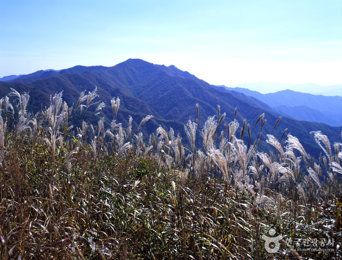
Situated in Jangsu-gun in Jeollabuk-do, Jangansan Mountain (alt. 1,237 m) was officially designated a county park in 1986. Deoksan Valley Stream, which originates in the southwestern part of Jangansan Mountain and flows into Yongnimcheon Stream, is famous for the Deoksanyongso Waterfall Basins and the 20 or so large rocks that dot its banks. The sprawling fields of reeds along the East Ridge are also a major draw, undulating like waves of gold in the crisp autumn wind. In particular, the east hiking path on Jangansan Mountain is lined with a wide field of silver grass making it popular among hikers.
Inquiry
+82-63-350-2445
Homepage
Information Use
Contact and Information : • 1330 Travel Hotline: +82-2-1330
(Korean, English, Japanese, Chinese)
• For more info: +82-63-350-2445
Parking facilities : Available
Day off : N/A (Open all year round)
More information
Hiking Course
Course 1: Muryonggogae Pass → Jangansan Mountain (3.2 km, 1 hr 30 min)
Course 2: Milmokjae Pass → Jangansan Mountain (9 km, 4 hr 30 min)
Course 3: Jisogol Valley → Jangansan Mountain (3 km, 1 hr 30 min)
Course 4: Goeomokdong → Jangansan Mountain (5 km, 2 hr 30 min)
Course 5: Yeonju → Jangansan Mountain (5.7 km, 2 hr 30 min)
Course 6: Beomyeondong → Jangansan Mountain (5.5 km, 2 hr 30 min)
Areas Open to the Public
Muryeonggogae Pass – Jangansan Mountain (2.5 km)
Restricted Mountain Areas
Eojae – Eochijae (2.2 km)
Mountain Not Access Period
Seasonal Forest Fire Watches
Spring: February 1-May 15
Autumn: November 1-December 15
* Periods and areas are subject to change based on fire weather advisories, snow/precipitation levels, and other local conditions.
Restrooms
Available
Admission Fees
Free
Location
Jangan-ri, Jangsu-gun, Jeonbuk-do


 English
 한국어
한국어 日本語
日本語 中文(简体)
 Deutsch
 Français
 Español
 Русский