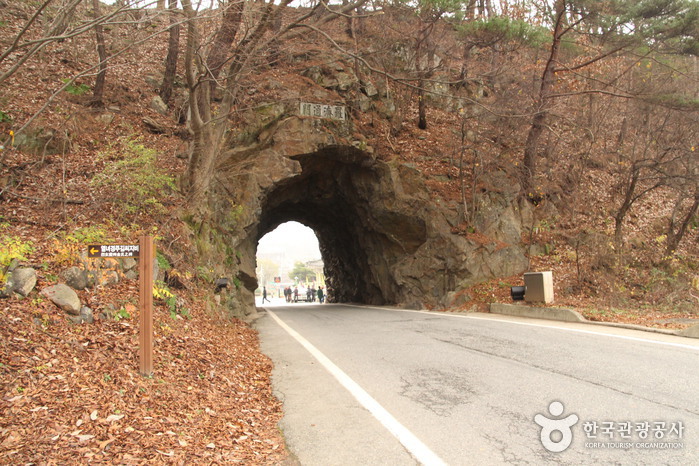
Rajetongmun Gate (라제통문)
10.7Km 2024-04-07
Rajetongmun-ro, Muju-gun, Jeonbuk-do
+82-63-322-2905
The historical border of the Silla and Baekje Kingdoms, Rajetongmun Gate of Seolcheon-myeon, Muju was formed from a rock cave in Seokgyeonsan Mountain. The tunnel is approximately 3 meters in x_height and 10 meters in length, and divides the villages of Sindu Maeul into Dugil-ri, Seolcheon-myeon and Inam Maeul in Socheon-ri. During the Three Kingdoms Period, the rocky ridges of Seokgyeonsan Mountain drew the boundary of Silla's Mupung in the east with Baekje's Seolcheo to the west.
Tracing the history from the Three Kingdoms Period to the Goryeo dynasty, the cultures and traditions of the two regions were markedly different. If curious about the difference, one could simply stop by Seolcheon on market day, where the Muju and Mupung local
dialects and customs can easily be distinguished.
People used to cross Seokgyeonsan Mountain by a footpath along the rocky ridge to travel between Seolcheon and Mupung. During the Japanese occupation, a new road was created by turning a cave into a tunnel through the mountain so cows and horse carts could freely pass from Muju to Gimcheon.
General Kim Yoo Shin from the Silla Kingdom, the hero of unification of the Three Kingdoms, often passed by the gate, later giving rise to the gate's nickname, Tongilmun (literally "Unification Gate"). The gate
is number one on the list of 33 scenic sites in Gucheon-dong.
Taekwondowon Spirit Zone (태권도원 상징지구)
12.1Km 2025-10-23
1482 Museol-ro, Seolcheon-myeon, Muju-gun, Jeonbuk-do
+82-63-320-0114
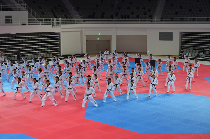
Taekwondowon Spirit Zone is a space that implements three elements - physical strength, mental awareness, and higher wisdom -- which enable practitioners to become 'Taekwondo individuals' through endless physical training and martial arts exploration. There are forty-five programs themed around Taekwondo education and practices, as well as experience and cultural exchanges. The facility is open to anyone who has learned Taekwondo, both at home and abroad as well as those looking to discipline their minds and bodies through Taekwondo, including businesses, students, and the general public. The Pyeongwon Gwan at Taekwondowon is the national team’s comprehensive training facility, where the Taekwondo Poomsae national team members, junior national team members, the national reserve teams, and demonstration teams have their training sessions.
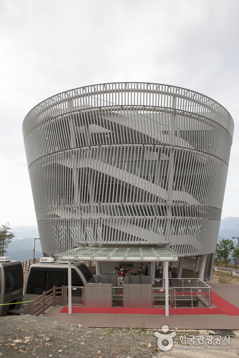
Taekwondowon Observatory (태권도공원 전망대)
12.1Km 2024-04-07
1482, Museol-ro, Muju-gun, Jeonbuk-do
+82-63-320-0114
Taekwondowon located in Muju-gun, Jeollabuk-do, serves as a main center for the 60 million taekwondo practitioners in 182 countries worldwide. Covering an area of 2.31 million square meters, the park combines the traditional and modern style in their buildings.
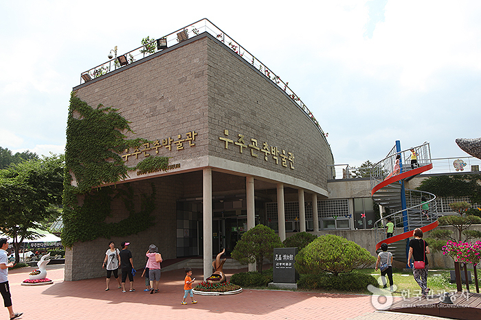
Bandi Land (무주 반디랜드)
12.6Km 2024-04-07
1324, Museol-ro, Muju-gun, Jeonbuk-do
+82-63-324-1155
Geared mainly towards children, Bandi Land is an excellent place to learn about and experience fireflies and other insects. It is comprised of Insect Museum, Firefly Research Center, Youth Campground, Log Cabin, and Firefly Habitat.
Located inside of Bandi Land, Muju Bandibyeol Astronomical Science Museum teaches various stories about space, including the birth & history of space, the solar system, constellations, and space circumstances. The Environment Theme Park also has exhibitions related to fireflies, an indicator insect proving Muju is a clean area, and other local insects, perfect for educational trips.
Skylake (하늘호수)
13.4Km 2025-10-23
793 Songgye-ro Buksang-myeon, Geochang-gun, Gyeongsangnam-do
+82-55-945-2380
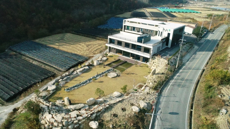
Skylake is a 20-year-old natural herbal cosmetics manufacturer and distributor located at the foot of Deogyusan Mountain in Geochang, Gyeongsangnam-do. The company runs natural-cosmetic-making programs using natural ingredients made with their know-how. Skylake was chosen as a wellness facility by the Korea Tourism Organization. Here, you can make a toner, essence, or an all-in-one wash on your own. After finishing the experience program, you can enjoy a cup of tea at the cosmetic cafe. Furthermore, you can purchase Skylake's cosmetic products at a discounted price on the day of the program. Reservations are required.
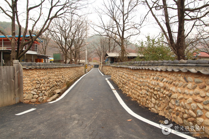
Old Walls of Jijeon Village in Muju (무주 지전마을 옛 담장)
14.3Km 2024-04-07
13, Gilbonji-gil, Muju-gun, Jeonbuk-do
+82-1899-8687
The Old Walls of Jijeon Village in Muju were mostly all built to mark the dividing line between houses, rather than to keep people out. The walls started out using mud and natural stones, but later changed to more square-shaped stones held together with cement and topped with Korean roofing tiles. The wall blends in harmony with the traditional houses of the village and the slowly flowing Namdaecheon Stream.
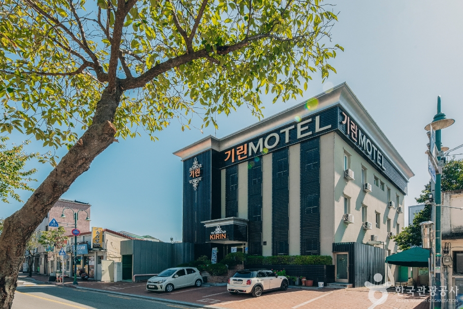
Kirin motel (기린모텔)
15.7Km 2024-12-24
74 , Dancheon-ro, Muju-gun, Jeonbuk-do
+82-63-324-5051, +82-10-4120-5562
Kirin Motel is in the center of Muju-eup, Jeollabuk-do, and is conveniently located for restaurants, shops and other facilities. Completely remodeled in 2018, the motel is modern and clean. Muju Resort and Gucheon-dong Valley are 25 minutes away by car, and the Muju Firefly Festival venue just a walk away. While the motel is especially popular during the festival, room prices stay the same year-round.

Geochang Wolseong Space Creative Science Museum (거창월성우주창의과학관)
15.9Km 2024-02-23
1312-96 Deogyuwolseong-ro, Buksang-myeon, Geochang-gun, Gyeongsangnam-do
Geochang Wolseong Space Creative Science Museum serves as an interactive science museum, providing opportunities for knowledge acquisition and hands-on experiences related to the universe. The facility is well-equipped for celestial observation, featurig key components like the Astronaut Center, Space Exploration Center, and Celestial Observation Center. Visitors can engage in various experiential programs, including activities such as donning AR space suits, coloring their own universe, and experiencing sensory balance.
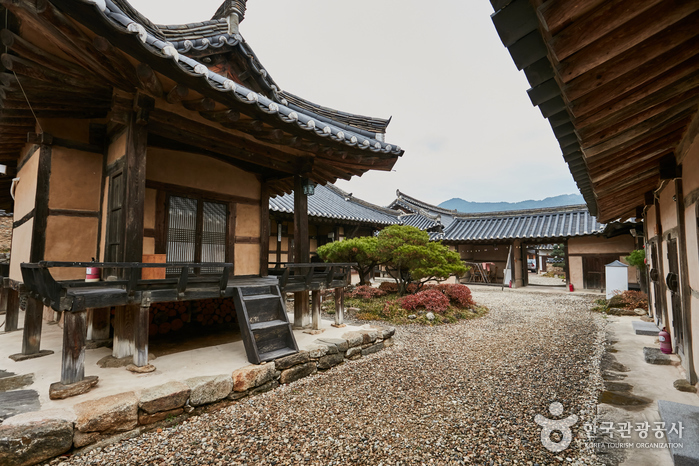
Wonhak Goga (원학고가)
16.2Km 2024-08-05
109-5 , Hwangsan 1-gil, Geochang-gun, Gyeongsangnam-do
+82-55-943-3104, +82-10-5359-2224
Wonhakgoga is a large and imposing hanok in the center of Hwangsan Village, Geochang, Gyeongsangnam-do - not far from the famous Suseungdae Rock - and was head house of the Geochang Shin Clan for around 500 years. The house’s fine gabled roofs, large pillars and foundation stones, and decoration of the kind usually found in palaces and temples mark it out as home to a prestigious family. Visitors can stay in Jungmunchae, Daemunchae or Sarangchae - the latter of which has a bathroom and toilet. Wonhakgoga is a good base for visiting the annual 인재
Wolseonggyegok Valley (월성계곡)
16.4Km 2024-02-23
Wolseong-ri, Buksang-myeon, Geochang-gun, Gyeongsangnam-do
Wolseonggyegok Valley is formed by the eastward flow of Wolseongcheon Stream, creating a remarkable landscape as the water winds around rocks and cliffs, earning it the nickname Geochang's Sogeumgang. Though narrow, the valley boasts a deep mountain terrain with abundant water flow. At the entrance of the valley, there are notable sites like Gangseondae Overlook, where it is said that immortals descended from heaven to enjoy the scenery, as well as the ancient Moamjeong and Deoksanjeong Pavilions.
 English
 한국어
한국어 日本語
日本語 中文(简体)
 Deutsch
 Français
 Español
 Русский