
Seoamjeongsa Temple (서암정사(함양))
11.2Km 2024-02-21
27-79 Gwangjeom-gil, Macheon-myeon, Hamyang-gun, Gyeongsangnam-do
Seoamjeongsa Temple belongs to Byeoksongsa Temple, which is at the entrance of the Chilseongyegok Valley of Jirisan Mountain. Monk Woneung rebuilt Byeoksongsa Temple, which had been damaged during the Korean War in 1950. This hermitage features the Buddha statues Woneung carved into the natural bedrock, a grotto sanctuary with statues of the Pure Land, Daebanggwangmun Gate, and Sajagul Cave.
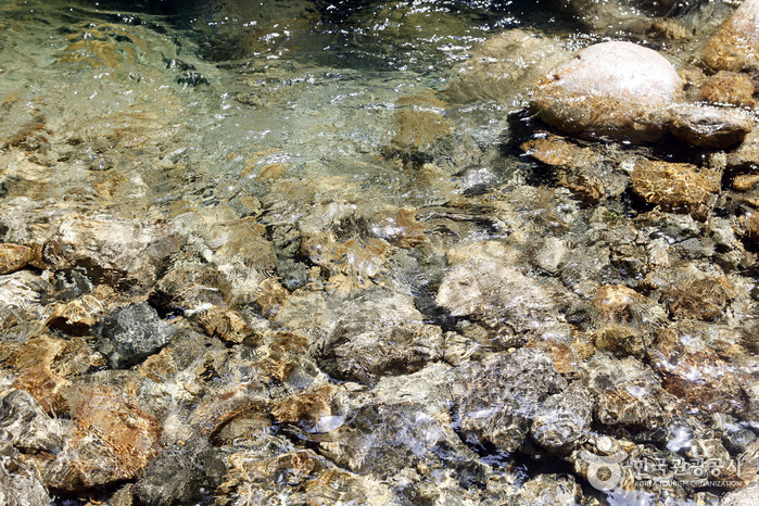
Jirisan Chilseongyegok Valley (칠선계곡(지리산))
11.7Km 2022-07-29
Chuseong-ri, Hamnyang-gun, Gyeongsangnam-do
Chilseongyegok Valley is the most beautiful valley in Jirisan Mountain, and is one of the top three valleys in the nation, along with Cheonbuldonggyegok Valley in Seoraksan Mountain and Tamnagyegok Valley in Hallasan Mountain. The 16-kilometer valley stretching from Uitan of Macheon-myeon to Cheonwangbong Peak is characterized by very tough topography but beautiful scenery and is the only remaining primeval forest of Jirisan Mountain. It is also dotted with seven waterfalls and 33 ponds. The hike becomes more difficult as the trail enters the valley. Because the valley has taken many lives, some people call it "The Valley of Death." For that reason, visitors must apply in advance and hike with a guide. The trail in Chilseon Valley is a 9.4-kilometer course from Chuseong Village in Macheon-myeon to Cheonwangbong Peak, which does not follow the natural valley, due to the valley's steep and dangerous features. Starting from Chuseong Village, the trail passes Yongso Pond, Jujiteo Site, Chuseongmang Rock, Seonnyeotang Pond, Ongnyeotang Pond, Biseondam, Chilseonpokpo Falls, Daeryukpokpo Falls, Samcheungpokpo Falls and Mapokpo Falls, all before reaching Cheonwangbong Peak.
Guryonggyegok Valley (구룡계곡)
11.9Km 2024-04-07
Guryongpokpo-gil, Namwon-si, Jeonbuk-do
Guryonggyegok Valley, a 3 kilometer-long valley in the northern part of the Jirisan National Park, located in Namwon, Jeollabuk-do, is just the place to enjoy a panoramic view of the unusually shaped rocks and precipitous cliffs. Under the Guryongpokpo Falls, located at the peak of the valley, is a small pond called, ‘Yongso’ (meaning ‘dragon pond’). Legend has it that a dragon lived here before it ascended to heaven. Visitors can tour the valley by driving along the skyway, an extension of the tourist road of Jirisan Mountain, or take an invigorating hike up a mountain by taking the Jeongnyeongchigan route, which extends along the valley to Baemsagol Valley(Banseon) and Nogodan Peak.
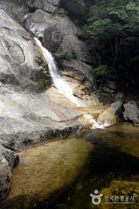
Burilpokpo Falls (불일폭포)
11.9Km 2024-02-08
103 Mogap-gil, Hwagae-myeon, Hadong-gun, Gyeongsangnam-do
Situated 720 meters above sea level, Burilpokpo Falls stands as the tallest waterfall on Jirisan Mountain, boasting a x_height of 60 meters and a x_width of 3 meters. It features a distinctive two-tier structure, with the enchanting Yongchumot and Hangmot Ponds nestled below, adding to its profound natural allure. Conveniently located just 3 kilometers from Ssanggyesa Temple, it's an ideal spot to visit following a trip to the temple.
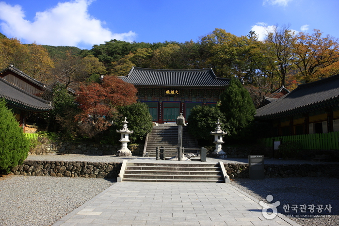
Hadong Ssanggyesa Temple (쌍계사(하동))
12.3Km 2024-03-08
59 Ssanggyesa-gil, Hadong-gun, Gyeongsangnam-do
Ssanggyesa Temple was founded on the southern foothills of Jirisan Mountain in 722 during the reign of Silla King Seongdeok. The temple is famous for the 6-kilometer stretch of cherry blossom trees that bloom each spring. The temple was originally called Okcheonsa Temple, but was changed to the current Ssanggyesa Temple in 887. The current temple buildings were all built in 1632, after having been burned down during the Imjin War (1592-1598). The temple grounds and nearby area feature many historic and beautiful attractions, including Burilpokpo Falls and a large tea plantation.
Gurye Cheoneunsa Temple (천은사(구례))
12.6Km 2021-10-02
209, Nogodan-ro, Gurye-gun, Jeollanam-do
Located north of Gurye on Jirisan Mountain, and built during the Unified Silla Period, Cheoneunsa Temple is one of the three great Buddhist temples of Jirisan Mountain. Cheoneunsa Temple is believed to have been built by Monk Deokun and Monk Seru from India in AD 828 during the 3rd year of King Heungdeok. Because it initially laid next to spring water as clean and cold as a morning dew, the temple was also called Gamrosa, meaning Sweet Dew Temple. The spring water was rumored to clean one’s body and soul, leading to crowd of Buddhist monks to visit the temple. During King Chungryeol’s reign, the temple was named the Best Temple in the south.
The temple was burned down during the Imjin War (1592-1598) and then later rebuilt and renamed Cheoneunsa. Legend has it that while the temple was being rebuilt, a large serpent often came out of the spring. When the serpent was finally captured and killed, the spring waters suddenly dried up. Hence the name Cheoneunsa, meaning Disappearance of Spring Water, was given.
![[Jirisan Trail Course] Inwol-Geumgye](http://tong.visitkorea.or.kr/cms/resource/73/1918173_image2_1.jpg)
[Jirisan Trail Course] Inwol-Geumgye
13.7Km 2024-04-06
308-1 Junggun-ri, Inwol-myeon, Namwon-si, Jeonbuk-do
Inwol-Geumgye Trail Course is part of the Jirisan Trail, starting from Inwol-myeon, Namwon-si, Jeollabuk-do, and passing through Deunggujae in Hamyang-gun, Gyeongsangnam-do, before reaching the village of Geumgye. Covering a distance of 20.5 kilometers, completing the trail typically takes around 10 hours, leading many travelers to plan a 1-night, 2-day itinerary. Along the way, hikers can enjoy the majestic landscapes of Jirisan Mountain, vast rice paddies, and visit six mountain villages.
Dosimdawon (도심다원)
13.8Km 2025-10-23
51-2 Sinchondosim-gil, Hadong-gun, Gyeongsangnam-do
Hadong's tea fields, which are known as the thousand-year-old tea fields, are characterized by being wild rather than cultivated. Among the many tea gardens in Hadong, the one with the most beautiful and peaceful scenery is Dosimdawon. In “House on Wheels,” actor and singer Yim Si-wan and Girls' Generation Yoona sat in a pavilion and sipped green tea while looking out at the green tea fields stretched out below. Tea utensils and tea leaves in a picnic basket are available for rent so that you can brew your own tea.
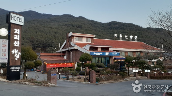
Hotel Jirisan Haetsal (지리산햇살)
13.8Km 2024-12-23
386-3 , Hwaeomsa-ro, Gurye-gun, Jeollanam-do
Jirisan Haetsal hotel (haetsal means ‘sunshine’) stands at the foot of Jirisan Mountain, Jeollanam-do. It’s just 300m from Jirisan National Park’s Nambu Visitor Center, and the scenery is very beautiful, with Jirisan rising up behind the hotel and the Masancheon mountain stream flowing past it. The hotel has a 4-person ondol room, with all the other rooms having beds; there is also a 6-person special room with a terrace. Guestrooms are cleaned dailly. Guests can enjoy a barbecue outside while listening to the babble of the stream. Gurye Bus Terminal, Hwaeomsa Temple, Gurye 5-day Market, and Gurye Unjoru Old House are all about 10 minutes away by car.
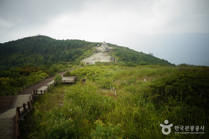
Jirisan National Park (Nogodan Peak Section) (지리산국립공원 (지리산 노고단))
14.1Km 2021-12-25
356, Hwaeomsa-ro, Gurye-gun, Jeollanam-do
Jirisan National Park covers a vast amount of land in three provinces, including one city and three counties. The countless mountain peaks both large and small blend harmoniously, giving off a comforting ambiance. The valleys feature streams, waterfalls, and more natural attractions beautiful all year round. The mountain is the starting point for the Seomjingang River, which flows into the southern sea.
The park is home to many plants and animals, including the Asiatic black bear. There are many hiking paths crossing the park; it is recommended to make a plan for the courses in advance, checking the lengths and time required. As Jirisan Mountain changes with the different seasons, hikers can enjoy various aspects of the mountain’s terrain. However, some areas will be closed off for hikers' safety in the case of incliment weather or to prevent forest fires in the dry season.
 English
 한국어
한국어 日本語
日本語 中文(简体)
 Deutsch
 Français
 Español
 Русский