![SI J.Lindeberg - Shinsegae Paju Branch [Tax Refund Shop] (SI 제이린더버그 신세계파주)](http://tong.visitkorea.or.kr/cms/resource/72/2889172_image2_1.jpg)
SI J.Lindeberg - Shinsegae Paju Branch [Tax Refund Shop] (SI 제이린더버그 신세계파주)
8.1Km 2024-04-18
200, Pilseung-ro, Tanhyeon-myeon, Paju-si, Gyeonggi-do
-
![Le Coq - Shinsegae Paju Branch [Tax Refund Shop] (르꼬끄 신세계파주)](http://tong.visitkorea.or.kr/cms/resource/75/3314375_image2_1.jpg)
Le Coq - Shinsegae Paju Branch [Tax Refund Shop] (르꼬끄 신세계파주)
8.1Km 2024-06-27
#1014, 200 Pilseung-ro, Tanhyeon-myeon, Paju-si, Gyeonggi-do
-
![The Izzat Collection - Shinsegae Paju Branch [Tax Refund Shop] (아이잗컬렉션 신세계파주)](http://tong.visitkorea.or.kr/cms/resource/16/3313416_image2_1.jpg)
The Izzat Collection - Shinsegae Paju Branch [Tax Refund Shop] (아이잗컬렉션 신세계파주)
8.1Km 2024-06-27
200 Pilseung-ro, Tanhyeon-myeon, Paju-si, Gyeonggi-do
-
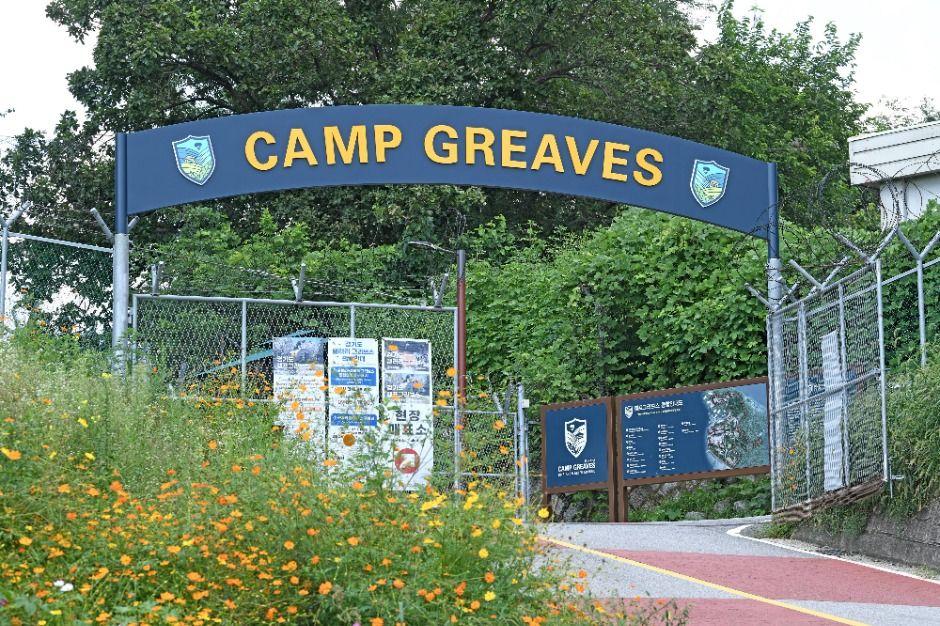
Camp Greaves DMZ Experience Center (캠프 그리브스)
8.1Km 2025-10-23
137 Jeoksipja-ro, Paju-si, Gyeonggi-do
+82-31-953-6970
Camp Greaves served as a camp base for the 506th US Second Infantry Division for about 50 years after the ceasefire agreement of the Korean War. The land was given back to the Korean government in 2007. The camp has been turned into a peace and security experience facility, and it is located approximately 2 kilometers away from the DMZ. It is also the first youth hostel to be located within a restricted area for civilians in Paju city.
An entire building of the US Army officer quarters was remodeled into a youth hostel and can accommodate up to 240 guests. The hostel is comprised of an office, a small auditorium on the first floor, rooms on the second and third floors, and a large auditorium on the fourth floor. The camp offers diverse programs including educational programs.
◎ Travel information to meet Hallyu’s charm
This is where NCT Dream photographed the cover for their first full-length album, “Hot Sauce.” It has been a U.S. military base for more than 50 years, so it’s a great place to go for an outing, with a variety of exhibits and picturesque landscapes.
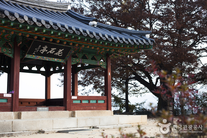
Hwaseokjeong Pavilion (화석정)
8.3Km 2021-12-14
152-72, Hwaseokjeong-ro, Paju-si, Gyeonggi-do
+82-31-940-5831
Hwaseokjeong Pavilion was built in honor of Gil Jae, a Goryeo dynasty Confucian scholar who had resigned from his government post to train young scholars. Overlooking the Imjingang River, the pavilion provides a good resting area dotted with zelkova trees.
![Himart - Geumchon Branch [Tax Refund Shop] (하이마트 금촌점)](http://tong.visitkorea.or.kr/cms/resource/73/2889973_image2_1.jpg)
Himart - Geumchon Branch [Tax Refund Shop] (하이마트 금촌점)
8.4Km 2024-04-18
202, Jungang-ro, Paju-si, Gyeonggi-do
-

Olive Young - Paju Geumneung Station Branch [Tax Refund Shop] (올리브영 파주금릉역점)
8.4Km 2024-06-27
1F, 84, Geumneungyeok-ro, Paju-si, Gyeonggi-do
-
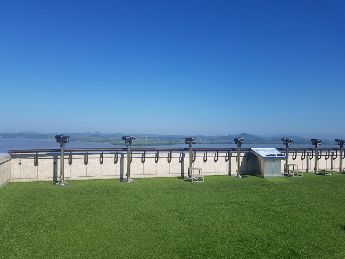
Odusan Unification Observatory (오두산 통일전망대)
8.9Km 2024-12-03
369 Pilseung-ro, Paju-si, Gyeonggi-do
+82-31-956-9600
Located in Tanhyeon-myeon, Paju-si, Odusan Unification Observatory was established to console the feelings of dispersed families and provide an educational site for the unification education through 5F to B1 in 1992.
The observatory is situated in the northernmost ceasefire line of the western front where the Hangang River and Imjingang River meet. It offers a wide view of Songaksan Mountain in Gaeseong to the north and 63 Building in Seoul to the south. Also, it is a valuable unification security tourist attraction related to Imjingak, the 3rd Tunnel, and Panmunjeom (Joint Security Area) stretching along Jayu-ro Road in the northeast.
Since its opening, almost 1,900,000 people have visited the observatory to feel the reality of the division, making this area the best national unification education site.
![E-Mart - Paju Branch [Tax Refund Shop] (이마트 파주)](http://tong.visitkorea.or.kr/cms/resource/46/2888946_image2_1.jpg)
E-Mart - Paju Branch [Tax Refund Shop] (이마트 파주)
8.9Km 2024-04-22
10, Dangha-gil, Paju-si, Gyeonggi-do
-
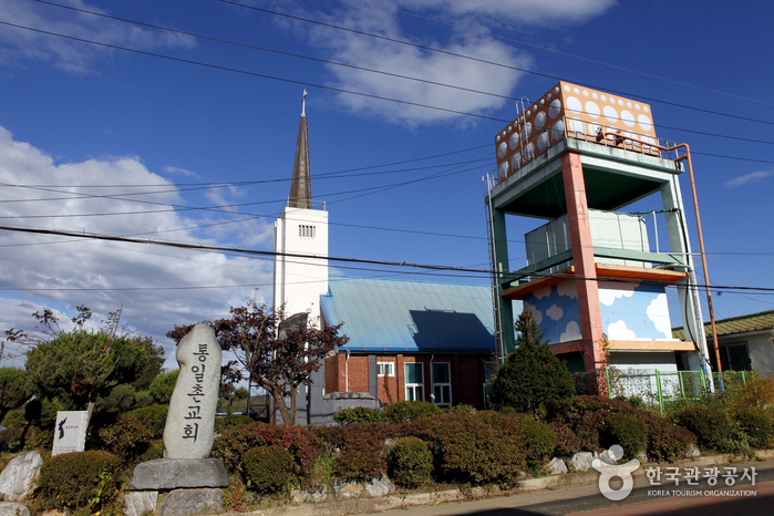
Unification Village (통일정보화마을)
8.9Km 2025-01-17
330-7, Baegyeon-ri, Gunnae-myeon, Paju-si, Gyeonggi-do
Paju’s Unification Village is located north of the Civilian Control Line (CCL). It has security tour locations, such as Panmunjeom, The 3rd Tunnel, and the Dora Observatory. The village is also famous for its agricultural products, such as Jangdan ginseng, Jangdan soybeans, and Jangdan rice, grown in the fertile and blessed nature of the area. Applications for Panmunjeom visits can be made a month in advance, starting from the 10th day of that month. Visitors are required to bring their passports for identification purposes. Nearby tourist sites include Imjingak Pavilion and Paju Book City.
 English
 한국어
한국어 日本語
日本語 中文(简体)
 Deutsch
 Français
 Español
 Русский