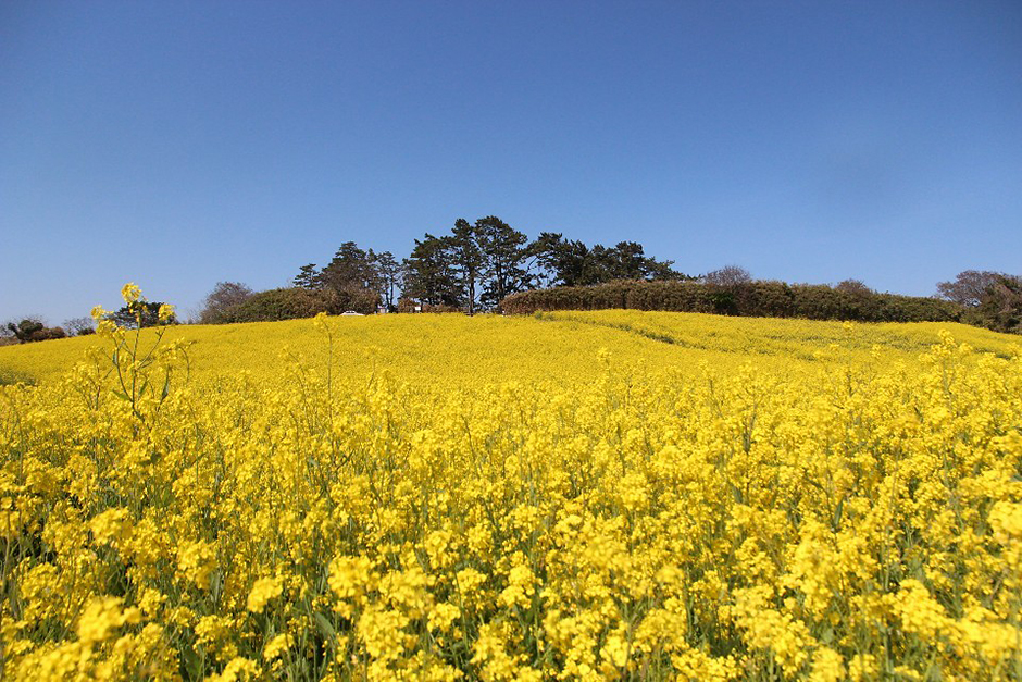
Suseongdang Canola Field (수성당유채꽃)
18.5Km 2024-04-07
252-11 Gyeokpo-ri, Byeonsan-myeon, Buan-gun, Jeonbuk-do
Suseongdang Canola Field refers to the colony of canola flowers that can be found along the trekking course connecting Saemangeum Information Center and Byeonsan Beach. Located near Suseongdang Shrine, the canola field spreads across an area of 32,000 ㎡, and transforms into a field of buckwheat flowers in summer, followed by cosmos flowers in fall, and becomes blanketed with snow in winter. This area is even more popular due to the scenery of canola flowers with an ocean backdrop as Jeju Island is the only other region in Korea to offer such scenery.
![Jeokbyeokgang Cliffs [National Geopark] (적벽강 (전북 서해안 국가지질공원))](http://tong.visitkorea.or.kr/cms/resource/30/3025630_image2_1.jpg)
Jeokbyeokgang Cliffs [National Geopark] (적벽강 (전북 서해안 국가지질공원))
18.5Km 2024-04-07
Gyeokpo-ri, Buan-gun, Jeonbuk-do
+82-63-584-0951
The area around Jeokbyeokgang Cliffs features great plant distribution value, including a population of Machilus, a designated natural monument. The cliffs are a great location for geological and ecological educational moments when visiting nearby attractions such as Chaeseokgang River and Gyeokgo Beach. The cliff is mostly composed of pepperlite, a unique rock that forms when volcanic rhyolite and sedimentary shale merge together.
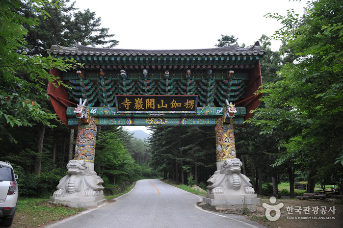
Gaeamsa Temple (개암사)
18.6Km 2024-04-07
248, Gaeam-ro, Buan-gun, Jeonbuk-do
+82-63-581-0080
Gaeamsa Temple is a small, quiet temple built in 634 during the Baekje dynasty. The origin of the name "Gaeam" goes back to 282 BC, when King Mun from the Byeonhan confederacy took refuge here during the revolt of the Jinhan and Mahan confederacies. Under King Mun's command, temples for the new fortress were built on east and west sides of the valley; the western temple was called Gaeam. In 676, the temple was expanded and in 1276, thirty more buildings were raised, expanding it to a grand temple.
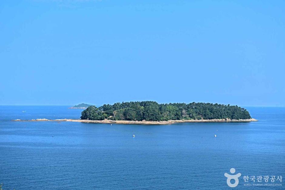
Haseom Observatory (하섬전망대)
18.8Km 2025-01-16
385-19 Mapo-ri, Byeonsan-myeon, Buan-gun, Jeonbuk-do
Haseom Observatory offers a bird’s-eye view of Haseom Island, which gets its name due to its resemblance to a lotus flower. The observatory is well-known for offering the views of sea parting, Korea’s Miracle of Moses, which occurs on the 1st and 15th of every month in the Lunar Calendar when the sea tides recede, revealing a 2-kilometers-long shoreline. It is famous for its abundance of clams, hence sometimes called “half clams-half mud.” The elevated location of the observatory allows visitors to enjoy the views of the wide sky and beautiful sunsets.
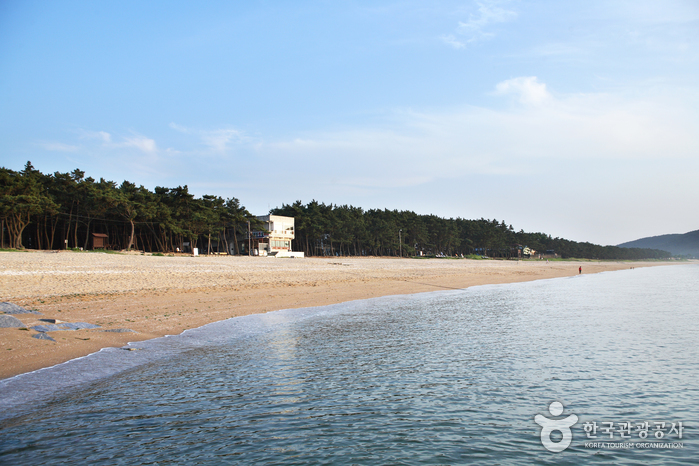
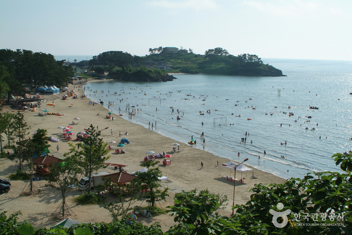
Gosapo Beach (고사포해수욕장)
19.0Km 2024-04-07
8-8, Norumok-gil, Buan-gun, Jeonbuk-do
+82-63-582-7808
Gosapo Beach commands a magnificent scenic view, thanks to the 2-kilometer stretch of fine sand and pine forest along the beach. The beach is considered one of the cleanest among the beaches in the area. Every two weeks, the tides fall to reveal a path from Gosapo Beach to Haseom Island.
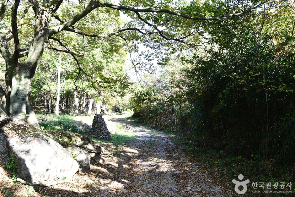
![[Byunsan Seashore Path- Course 3]Jeokbyeokgang Sunset Trail ([변산 마실길 3코스] 적벽강 노을길)](http://tong.visitkorea.or.kr/cms/resource/33/2942533_image2_1.jpg)
[Byunsan Seashore Path- Course 3]Jeokbyeokgang Sunset Trail ([변산 마실길 3코스] 적벽강 노을길)
19.0Km 2025-10-23
Byeonsan-myeon, Buan-gun, Jeollabuk-do
The Byeonsan Seashore Path is a scenic 66-kilometer coastal walk stretching from the Saemangeum Seawall to the Julpo Bay Tidal Flat Ecological Park. One of its highlights is Course 3 (Jeokbyeokgang Noeulgil), which offers breathtaking views of rock formations of the Cretaceous period in the Mesozoic Era along the Jeokbyeokgang Cliffs and Chaeseokgang Cliff. Gyeokpo Port provides fresh seafood and passenger ferry service to and from Wido Port. This course spans from Seongcheon Port to Gyeokpo Port, and when the tide is low, you can walk along the exposed shore, marveling at the unique rock formations and wildflowers along the way.
Gamami Beach (가마미해수욕장)
19.5Km 2021-12-08
355, Gamami-ro, Yeonggwang-gun, Jeollanam-do
+82-61-356-1020
Located 24 kilometers west of Yeonggwang-eup, Gamami Beach was first opened in 1925. The beach is 1 kilometer in length and 200 meters in x_width, and has the shape of a half moon. Around 200 pine trees encompass the area and form a dense cozy forest. The water is only about 1 to 2 meters deep and its clear waters make it one of the three best beaches in the southwestern part of Korea.
Small islands dot the sea in front of the beach and the view of the fishing boats drifting by is very peaceful. The sunset on the west gives off a different vibe from the sunrise of the east. Near the beach area is a coastal drive way with a wonderful view of the coast. Dombaeseom Island, famous for ocean fishing, and Chilsando Island are lined up more or less in a row.

National Jangseong Healing Forest (국립장성치유의숲)
19.7Km 2024-02-20
716 Chuam-ro, Seosam-myeon, Jangseong-gun, Jeollanam-do
National Jangseong Healing Forestis a natural recreational facility located in the Chungnyeongsan National Forest, opened in 2011. Visitors can be relaxed by walking along the cypress forest trail emitting phytoncides. There are seven hiking courses designed with various themes and slopes. Following the main course, the "Well-being Forest Path," hikers will encounter the Chungnyeongsan Observatory, where they can enjoy panoramic views of the mountain and see the cypress forest at a glance.
Gosan Mountain (고산)
19.7Km 2024-04-07
Sanggeum-ri, Daesan-myeon, Gochang-gun, Jeonbuk-do
Gosan Mountain is a beautiful mountain that rises sharply from the plains, offering stunning views from its summit at an elevation of 572 meters. The mountain delights hikers with lush pine forests and interesting rock formations. Gosan Mountain is also known for its numerous dolmens, dating back to prehistoric times, and the Gosansanseong Fortress, built during the Later Three Kingdoms period, providing plenty of attractions for visitors.
 English
 한국어
한국어 日本語
日本語 中文(简体)
 Deutsch
 Français
 Español
 Русский