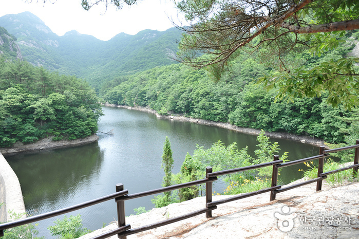
Naebyeonsan Mountain (내변산)
19.0Km 2024-04-07
232, Naebyeonsan-ro, Buan-gun, Jeonbuk-do
+82-63-584-7808
The Byeonsanbando Peninsula has a shoreline that stretches 99 kilometers, protruding into the west sea in Jeollabuk-do, with the Saemangeum, the world’s longest man-made sea barrier, to the north and Gomsoman Bay at its south shore. The peninsula is part of Byeonsanbando National Park, which is widely known for its natural beauty. Its interior mountain range is known as Naebyeonsan Mountain (Inner Byeonsan Mountain.) while the outer region near the sea is known as Oebyeonsan Mountain (Outer Byeonsan Mountain).
The center of Mountain Naebyeonsan includes the highest peak of Byeonsanbando peninsula, Uisangbong Peak (509 meters) and Nakjodae (Sunset Viewpoint), Wolmyeongam Hermitage, Bongnaegugok Valley as well as Jiksopokpo Waterfall. The surrounding mountains and valleys of Byeonsan Mountain are not particularly high, standing at an altitude of around 400-500 meters, but the magnificent formation of mountains and valleys as well as the breathtaking view of the sunset from Nakjodae make it a must-see sight.
Suseongdang Shrine (수성당)
19.4Km 2025-01-15
54 Jeokbyeokgang-gil, Buan-gun, Jeonbuk-do
Located at the end of Jeokbyeokgang Cliff, Suseongdang Shrine is the only shrine in Korea that is dedicated to the sea god “Gaeyang Halmeoni” (Granny Gaeyang), the deity who rules over the West Sea, and her eight daughters. This is a place that holds rituals for the welfare and safety of fishers. Visitors can also see cairns dedicated to the fishermens’ safety. For tourists, however, this shrine is notable for its canola flowers. In early spring, the road connecting Suseongdang Shrine with Jeokbyeokgang Cliff blooms in yellow canola flowers, creating a beloved view and a premier photo area of the region. It is a recommended spot to see the flowers when visiting Buan in springtime.

National Jangseong Healing Forest (국립장성치유의숲)
19.4Km 2024-02-20
716 Chuam-ro, Seosam-myeon, Jangseong-gun, Jeollanam-do
National Jangseong Healing Forestis a natural recreational facility located in the Chungnyeongsan National Forest, opened in 2011. Visitors can be relaxed by walking along the cypress forest trail emitting phytoncides. There are seven hiking courses designed with various themes and slopes. Following the main course, the "Well-being Forest Path," hikers will encounter the Chungnyeongsan Observatory, where they can enjoy panoramic views of the mountain and see the cypress forest at a glance.
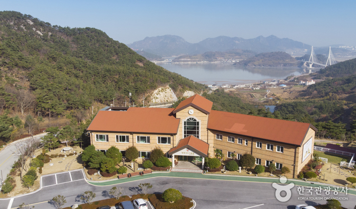
YeongGwang Country Club (영광컨트리클럽)
19.4Km 2024-12-24
1362-70 , Haean-ro, Yeonggwang-gun, Jeollanam-do
+82-61-350-2000
Yeonggwang West Ocean CC Golftel is located on Baeksu Coastal Road in Yeonggwang-gun, Jeollanam-do. Golftel guests can see the Chilsan Sea, Baeksu Coast Road, fine night views and beautiful natural scenery from their rooms, providing relaxing sensations and fond memories. A second 3-storey building was added to the Golftel in 2020.
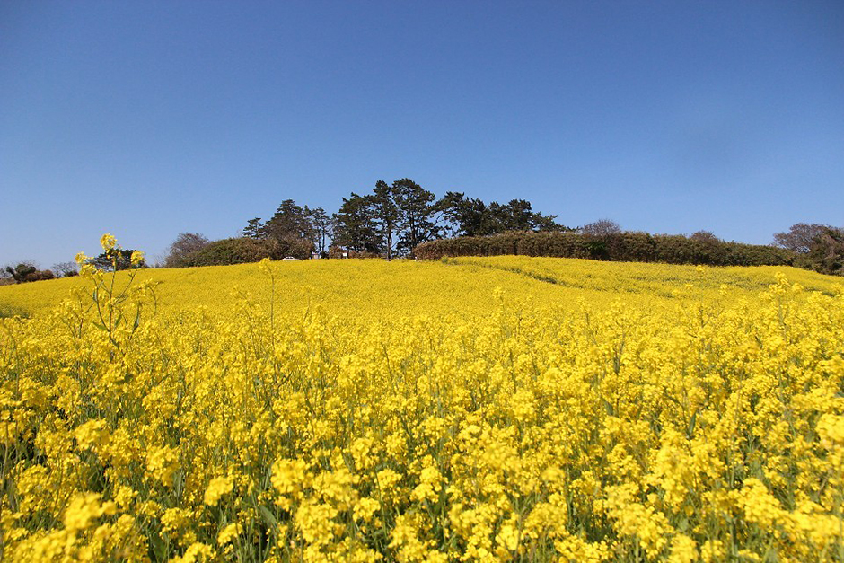
Suseongdang Canola Field (수성당유채꽃)
19.4Km 2024-04-07
252-11 Gyeokpo-ri, Byeonsan-myeon, Buan-gun, Jeonbuk-do
Suseongdang Canola Field refers to the colony of canola flowers that can be found along the trekking course connecting Saemangeum Information Center and Byeonsan Beach. Located near Suseongdang Shrine, the canola field spreads across an area of 32,000 ㎡, and transforms into a field of buckwheat flowers in summer, followed by cosmos flowers in fall, and becomes blanketed with snow in winter. This area is even more popular due to the scenery of canola flowers with an ocean backdrop as Jeju Island is the only other region in Korea to offer such scenery.
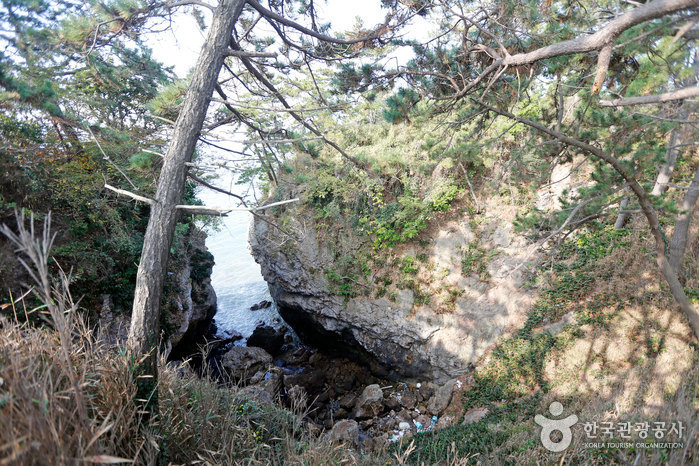
![Jeokbyeokgang Cliffs [National Geopark] (적벽강 (전북 서해안 국가지질공원))](http://tong.visitkorea.or.kr/cms/resource/30/3025630_image2_1.jpg)
Jeokbyeokgang Cliffs [National Geopark] (적벽강 (전북 서해안 국가지질공원))
19.5Km 2024-04-07
Gyeokpo-ri, Buan-gun, Jeonbuk-do
+82-63-584-0951
The area around Jeokbyeokgang Cliffs features great plant distribution value, including a population of Machilus, a designated natural monument. The cliffs are a great location for geological and ecological educational moments when visiting nearby attractions such as Chaeseokgang River and Gyeokgo Beach. The cliff is mostly composed of pepperlite, a unique rock that forms when volcanic rhyolite and sedimentary shale merge together.
 English
 한국어
한국어 日本語
日本語 中文(简体)
 Deutsch
 Français
 Español
 Русский