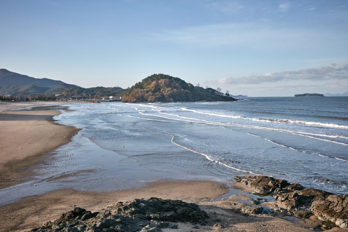
Byeonsan Beach (변산해수욕장)
.0M 2025-01-15
2076 Byeonsan-ro, Buan-gun, Jeonbuk-do
+82-63-583-6951
Byeonsan Beach is a representative beach of the west coast. The beach is known for its white sand and fir trees. Also, having opened in 1933, it is the oldest beach in Korea. The fine sandy beach stretches endlessly and the water is clear. Furthermore, the water is only 1 meter deep and warm, making it an ideal beach for playing in the water.

Byeonsan Oncheon Sanjang (변산온천산장)
2.6Km 2025-10-23
83-6 Mukjeong-gil Byeonsan-myeon, Buan-gun, Jeollabuk-do
+82-63-584-4874
Byeonsanbando, surrounded by the sea on three sides, is home to a lot of food using shellfish. Among them, it is the original house that first developed clam porridge, which is considered the most distinctive menu. If you add glasswort salt and sesame seeds to the unique savory taste of clams that harmonize with any other ingredients, it becomes a savory porridge that fills our stomachs. Sweet and sour seasoned Raw Clam Salad and Clam Vegetable Pancake are also prepared.
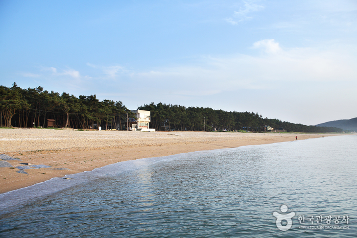
Gosapo Beach (고사포해수욕장)
2.9Km 2024-04-07
8-8, Norumok-gil, Buan-gun, Jeonbuk-do
+82-63-582-7808
Gosapo Beach commands a magnificent scenic view, thanks to the 2-kilometer stretch of fine sand and pine forest along the beach. The beach is considered one of the cleanest among the beaches in the area. Every two weeks, the tides fall to reveal a path from Gosapo Beach to Haseom Island.
![[Byunsan Seashore Path- Course 3]Jeokbyeokgang Sunset Trail ([변산 마실길 3코스] 적벽강 노을길)](http://tong.visitkorea.or.kr/cms/resource/33/2942533_image2_1.jpg)
[Byunsan Seashore Path- Course 3]Jeokbyeokgang Sunset Trail ([변산 마실길 3코스] 적벽강 노을길)
2.9Km 2025-10-23
Byeonsan-myeon, Buan-gun, Jeollabuk-do
The Byeonsan Seashore Path is a scenic 66-kilometer coastal walk stretching from the Saemangeum Seawall to the Julpo Bay Tidal Flat Ecological Park. One of its highlights is Course 3 (Jeokbyeokgang Noeulgil), which offers breathtaking views of rock formations of the Cretaceous period in the Mesozoic Era along the Jeokbyeokgang Cliffs and Chaeseokgang Cliff. Gyeokpo Port provides fresh seafood and passenger ferry service to and from Wido Port. This course spans from Seongcheon Port to Gyeokpo Port, and when the tide is low, you can walk along the exposed shore, marveling at the unique rock formations and wildflowers along the way.

Saemangeum Promotion Hall (새만금홍보관)
3.1Km 2025-11-05
6 Saemangeum-ro, Byeonsan-myeon, Buan-gun, Jeonbuk-do
Enjoy the panoramic view of Saemangeum
This is a PR center to commemorate the Saemangeum Project, which took 19 years to complete. It is a place that encompasses the past, present, and vision of Saemangeum. The inside is much larger and larger than it looks from the outside, and there are so many things to see. When you go up to the observatory on the 3rd floor, the magnificent panoramic view of Saemangeum spreads out in front of you, and you can observe distances beyond your reach with a telescope. Outside the Promotion Hall, there is a monument where BTS' music video is played. There is an endless stream of visitors sitting here and taking commemorative photos.
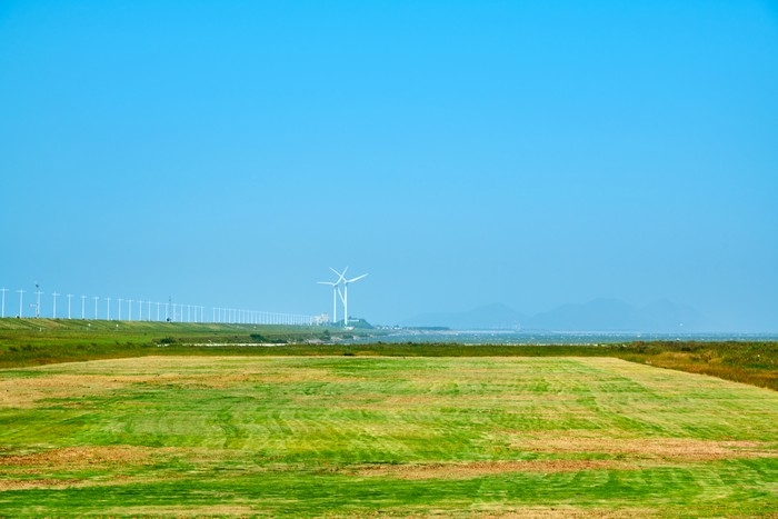
Saemangeum (새만금)
3.1Km 2025-10-23
6 Saemangeum-ro, Byeonsan-myeon, Buan-gun, Jeonbuk-do
+82-63-584-6822
Saemangeum is an area created by the reclamation project to build a sea wall connecting Gunsan and Buan. After 20 years of construction, the Saemangeum Seawall was completed in 2010. Stunning sunsets can be seen from the dike, and various facilities such as campgrounds and the Saemangeum Project Office are well prepared for visitors experience. It is also known as a filming location for BTS's music videos.
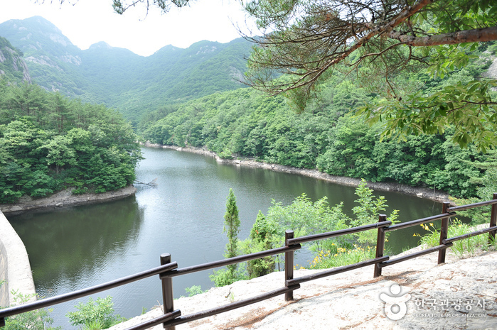
Naebyeonsan Mountain (내변산)
3.5Km 2024-04-07
232, Naebyeonsan-ro, Buan-gun, Jeonbuk-do
+82-63-584-7808
The Byeonsanbando Peninsula has a shoreline that stretches 99 kilometers, protruding into the west sea in Jeollabuk-do, with the Saemangeum, the world’s longest man-made sea barrier, to the north and Gomsoman Bay at its south shore. The peninsula is part of Byeonsanbando National Park, which is widely known for its natural beauty. Its interior mountain range is known as Naebyeonsan Mountain (Inner Byeonsan Mountain.) while the outer region near the sea is known as Oebyeonsan Mountain (Outer Byeonsan Mountain).
The center of Mountain Naebyeonsan includes the highest peak of Byeonsanbando peninsula, Uisangbong Peak (509 meters) and Nakjodae (Sunset Viewpoint), Wolmyeongam Hermitage, Bongnaegugok Valley as well as Jiksopokpo Waterfall. The surrounding mountains and valleys of Byeonsan Mountain are not particularly high, standing at an altitude of around 400-500 meters, but the magnificent formation of mountains and valleys as well as the breathtaking view of the sunset from Nakjodae make it a must-see sight.
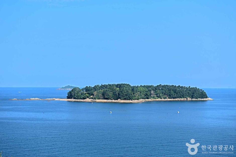
Haseom Observatory (하섬전망대)
4.2Km 2025-01-16
385-19 Mapo-ri, Byeonsan-myeon, Buan-gun, Jeonbuk-do
Haseom Observatory offers a bird’s-eye view of Haseom Island, which gets its name due to its resemblance to a lotus flower. The observatory is well-known for offering the views of sea parting, Korea’s Miracle of Moses, which occurs on the 1st and 15th of every month in the Lunar Calendar when the sea tides recede, revealing a 2-kilometers-long shoreline. It is famous for its abundance of clams, hence sometimes called “half clams-half mud.” The elevated location of the observatory allows visitors to enjoy the views of the wide sky and beautiful sunsets.

Byeonsanbando National Park (변산반도국립공원)
6.1Km 2024-04-07
11, Bangpaje-gil, Byeonsan-myeon, Buan-gun, Jeonbuk-do
+82+63-582-7808
Designated as a national park in 1988, Byeonsanbando National Park is the only national park in the country that consists of both the ocean and the mountains. The park is divided into two large sections: the shore area, called Outer Byeonsan, and an inland area called Inner Byeonsan. It has mountain peaks made up of unique rock formation, such as Uisanbong Peak (508 meters), Chaeseokgang Cliff, and Jeokbyeokgang Cliffs. Nearby Gyeokpo Port and Naesosa Temple are all worth exploring, enriching the experience of the area. It's also well known for having the latest sunset in the country with stunning panoramic views.
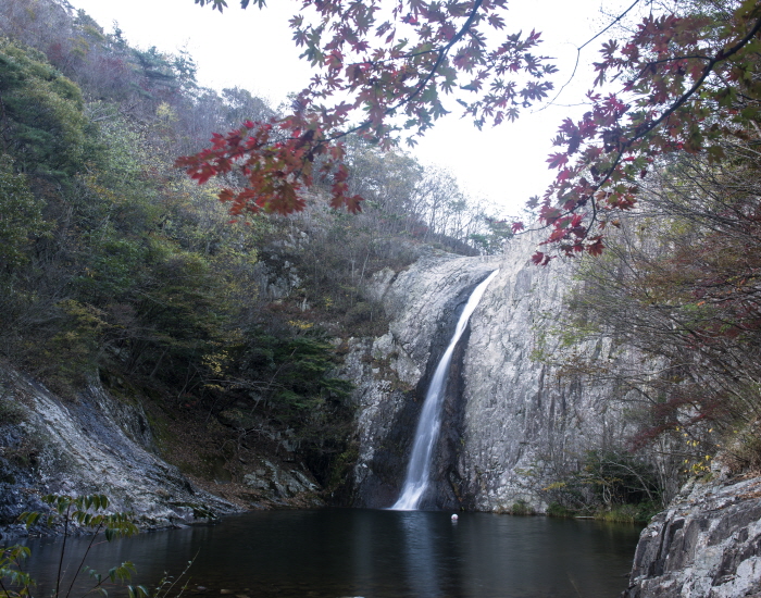
Jiksopokpo Falls - Jeonbuk National Geopark (직소폭포 (전북 서해안권 국가지질공원))
6.2Km 2025-03-15
62, Silsang-gil, Buan-gun, Jeonbuk-do
+82-63-580-4331
Jiksopokpo Falls is located within Bongnaegugok Valley. The waterfall is the largest in Byeonsanbando National Park, thundering down 30 meters. The waterfall can be reached by a hiking trail starting at Naesosa Temple. Known as one of the most beautiful sights in Byeonsanbando National Park, the waterfall is very popular with tourists.
 English
 한국어
한국어 日本語
日本語 中文(简体)
 Deutsch
 Français
 Español
 Русский