Seoul Mongchontoseong Earthen Fortification (서울 몽촌토성)
2024-03-12
424, Olympic-ro, Songpa-gu, Seoul
+82-2-2147-2814
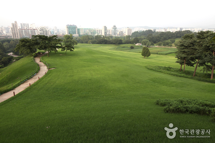
Mongchontoseong Earthen Fortification is an ancient earthen fortress built during the Hanseong period of the ancient Korean kingdom of Baekje (BC 18-AD 660). It is believed to have been constructed in the 3rd to 4th centuries. Utilizing the natural advantages of the Hangang River, it served defensive purposes with its trench and log barrier. Excavated relics from the Baekje era are on display at the Seoul Baekje Museum. The site is situated within the Olympic Park in Songpa, Seoul.
Seoul Bangidong Ancient Tombs (서울 방이동 고분군)
2022-12-29
219, Ogeum-ro, Songpa-gu, Seoul
+82-2-2147-2800
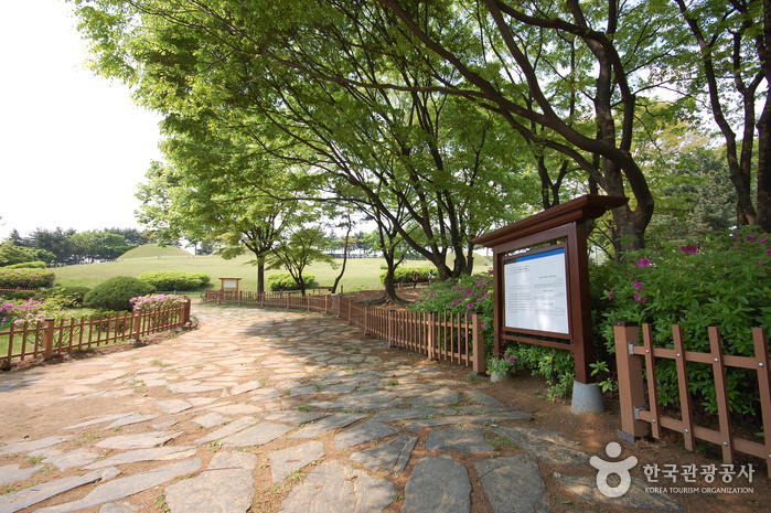
The ancient tombs in Bangi-dong were discovered during the land readjustment project of Jamsil-jigu District in 1975. A total of eight ancient tombs were excavated until 1976, and the site was restored into a park in 1983. The Bangi-dong area was originally a low line of hills with an altitude of 30-50 meters above sea level, but it has been made into flatland for urban development purposes. Tomb numbers 1 to 6 lie on the same hill, while tomb no. 7 and 8 are located on another hill a short distance away.
All eight tombs have circular burial mounds. The insides of the a tomb feature a square or rectangular-shaped burial chamber with earthen ground and stone walls, and a passage leading from the tomb entrance to the chamber. However, details of the burial chambers vary by tomb. Most of the tombs had been robbed before the investigation, but a few relics such as plates and pots have been excavated. At the time of excavation, the relics were presumed to have come from the Baekje dynasty (18 BC-660 AD), but it is now estimated that they date back to the Unified Silla Period (676-935 AD).
Banpo Seoraeseom Island (반포 서래섬)
2018-02-02
40, Sinbanpo-ro 11-gil, Seocho-gu, Seoul
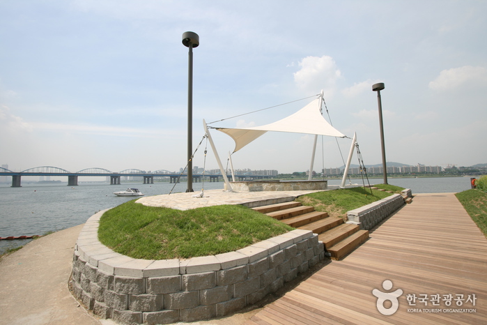
Banpo Seoraeseom Island is an artificial island built in the mid-1980s. Located in Banpo-jigu District by the Hangang riverside, the island is connected to Hangang Banpo Park by three bridges. The island features weeping willows along the edges, as well as a migratory bird habitat, flower garden, water ski site, and more.
Achasan Ecological Park (아차산생태공원)
2021-05-14
127, Walkerhill-ro, Gwangjin-gu, Seoul
+82-2-450-1655
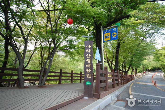
Achasan Ecological Park was established under the Seoul Metropolitan Government's Five Year Plan for Urban Green Expansion. Through various events and activities, the park provides opportunities to experience and learn about nature and its ecology. Major facilities include Eco Park, Rendezvous Square, Red Clay Road, Barefoot Path, Pine Forest, Mineral Spring, Eco Trail and pergolas.
Bukhansan National Park (Seoul District) (북한산국립공원(서울))
2024-11-27
262 Bogungmun-ro, Seongbuk-gu, Seoul
+82-2-909-0497
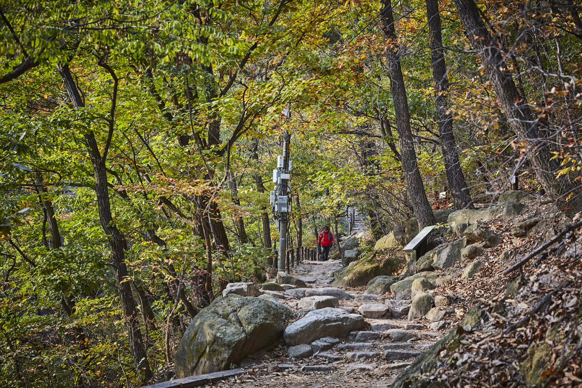
Bukhansan Mountain was officially designated as a national park in 1983. Bukhansan National Park covers both Bukhansan and Dobongsan Mountains, and spans a total area of 80.699 ㎢. At the top of Bukhansan Mountain are Baegundae Terrace (835.6 m), Insubong Peak (810.5 m) and Mangyeongdae Terrace (799.5 m), which gave the mountain the nickname "Samgaksan" or the "three-horned mountain." The mountain had other names: Sambongsan (mountain with three peaks), Hwasan (flower mountain), and Buaak (mountain shaped like a person giving a baby a piggyback ride). The current name, Bukhansan, was given after the Bukhansanseong Fortress was built under King Sukjong of the Joseon dynasty.
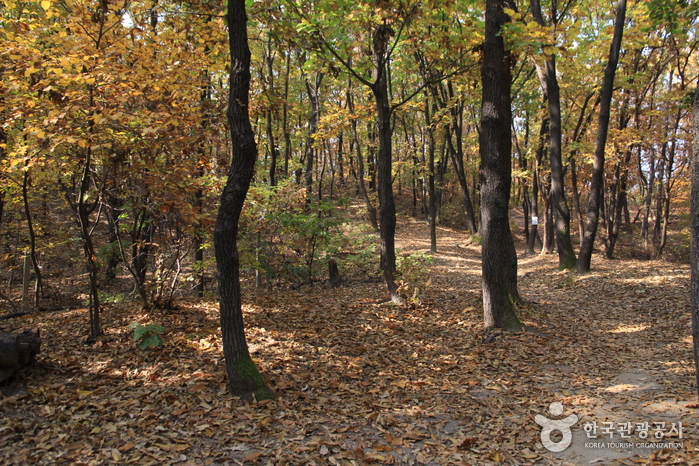
Dobongsan Mountain (도봉산)
2021-06-29
Dobong-dong, Dobong-gu, Seoul
+82-2-954-2566
Dobongsan Mountain, located in the northeastern section of Bukhansan National Park, is known for the magnificent rock formations of the main peak, Jaunbong Peak (740.2 m), as well as Manjangbong, Seoninbong, Jubong, Obong Peaks and Uiam Rock. Seoninbong Peak in particular has 37 hiking courses, including the famous Bakjwi (Bat) Course.
The mountain is also home to Cheonchuksa Temple, the oldest temple in the region, and several other temples including Mangwolsa and Hoeryongsa Temples, as well as a number of beautiful valleys such as Dobonggyegok, Songchugyegok, Obonggyegok and Yeongeocheongyegok Valleys. Dobongsan Mountain is easily accessible by public transportation, making it a popular attraction for people living in Seoul.
Jaunam Hermitage (자운암)
2023-05-08
Gwanak-ro, Gwanak-gu, Seoul
+82-2-882-3839
Jaunam Hermitage was originally built in 1396 by Great Monk Muhak of Joseon dynasty. It was renovated in 1734, and finally took shape of the hermitage we know today in 1976 when Monk Boryun added Daeungjeon Hall, Chilseonggak Pavilion, and Sansigak Pavilion. It is currently located in the famous Jahadong Valley on the Seoul National University campus.
Pungnap-dong Toseong Fortress (서울 풍납동 토성)
2025-01-10
Pungnap-dong, Songpa-gu, Seoul
+82-2-2147-2800
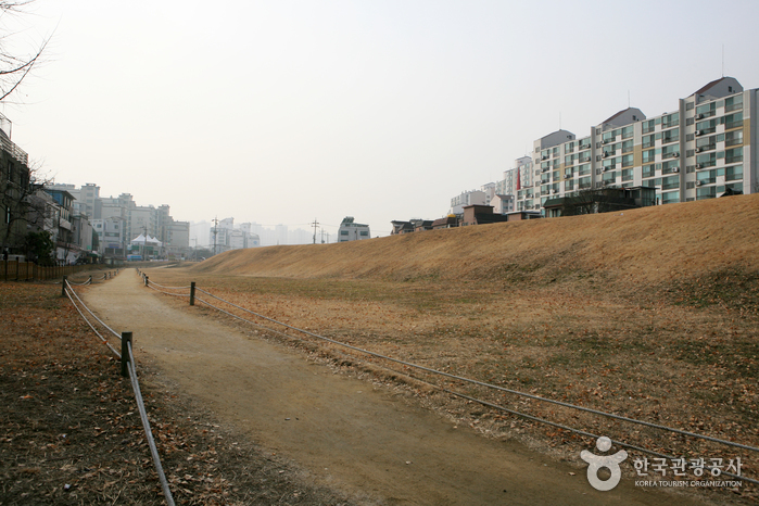
Onjo, the progenitor of Kingdom Baekje, first settled in Wiryeseong Hanam. But exact location is still unknown. One thing for sure, however, is that Pungnaptoseong Fortress, Mongchontoseong Fortress, Bangidong Ancient Tombs of Baekje, Seokchondong Stone Mound Tomb of Early Baekje are the remains of Baekje. Pungnaptoseong Fortress faces Hangang River to its west and connects to Mongchontoseong Fortress to the south. To the northwest faces Achasanseong Fortress over Hangang River and far to the southeast is Namhansanseong Fortress.
Pungnaptoseong Fortress, located at the south end of Cheonhodaegyo Bridge over Hangang River, is one of the remains of Early Baekje. Originally, the fortress was 4km in circumference, but due to massive overflowing of Hangang River during flood season in 1925, most of the fortress was lost and only 2.7km of it remains. To the east of the fortress are 4 vestiges of the fortress gates. The remains from the prehistoric era through the Samguk (Three States) era have been unearthed, indicating that this place was a residential area well before the Baekje Era. Through vigorous excavation, some people suggest that there used to be a palace located here during the Baekje Era.

Seoul Hyochang Park (서울 효창공원)
2024-07-09
177-18 Hyochangwon-ro, Yongsan-gu, Seoul
+82-2-2199-7608
Hyochang Park covers 122,245 square meters spanning across Hyochang-dong and Cheongpa 2-dong. It is a historic landmark that once contained several royal tombs, and was known at that time as Hyochangwon. The cemeteries that were originally located in Hyochangwon belonged to Crown Prince Munhyo, King Jeongjo’s first son who died at the age of five; Royal Noble Consort Uibin of the Seong Clan, King Jeongjo’s royal concubine and Crown Prince Munhyo’s mother; Royal Noble Consort Sugui of the Park Clan, King Sunjo’s royal concubine; and her daughter Princess Yeongon. The royal tombs were moved to Seooreung Tombs in the waning months of the Japanese colonial period. The Japanese empire began the development of Hyochangwon into a park in 1924, and the Japanese governor-general officially assigned the site as a park in 1940.
Presently, several of Korea’s greatest leaders are buried in Hyochang Park. The remains mostly belong to independence activists including Yoon Bong-gil, Lee Bong-chang, and Baek Jeong-gi, whose graves are collectively known as Samuisa Tomb. A statue of Lee Bong-chang has been built in the graveyard. Among the other patriotic martyrs who are interred in the park are Kim Gu and some of the key figures of the provisional government such as Lee Dong-nyeong, Cha I-seok, and Cho Seong-hwan. An ancestral shrine named Uiyeolsa has been built along the main gate and holds the portraits of the deceased independence activists.
Osaek Mineral Spring (오색약수터)
2022-12-22
Osaek-ri, Yangyang-gun, Gangwon-do
+82-33-672-2883
Osaek Mineral Spring is situated 20 kilometers west of Yangyang and 7.5 kilometers southeast from Hangyeryeong Pass. The water, which springs from three base rocks by a brook, is carbonated and rich in iron. Up to 1,500 liters of iron-rich water spring out on a daily basis. Osaek became well known due to the splendid landscape leading up to the mineral spring and its location on the way to the summit of Seoraksan Mountain.
 English
 한국어
한국어 日本語
日本語 中文(简体)
 Deutsch
 Français
 Español
 Русский