![[Long-lasting Small Business] Cheorwon Makguksu ([백년가게]철원막국수)](http://tong.visitkorea.or.kr/cms/resource/19/2565319_image2_1.jpg)
[Long-lasting Small Business] Cheorwon Makguksu ([백년가게]철원막국수)
6.6 Km 132 2024-03-20
13 Myeongseong-ro 158beon-gil, Galmal-eup, Cheorwon-gun, Gangwon-do
Cheorwon Makguksu boasts a 60-year tradition, offering a testament to its culinary expertise. The restaurant is known for pairing its makguksu with nokdu bindaetteok (mung bean pancake) and pyeonyuk (boiled pork slices), creating a harmonious trio that is often ordered together. Their mul makguksu features buckwheat noodles in a deep and cool broth, delivering a rich flavor without being overwhelming. The noodles are both chewy and tender, striking a perfect balance. Additionally, the dish is garnished with sweet-and-sour musaengchae (julienne radish fresh salad), adding a savory and clean note.
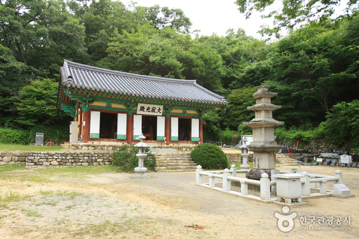
Cheorwon Dopiansa Temple (도피안사(철원))
6.9 Km 12718 2022-11-14
23, Dopidong-gil, Cheorwon-gun, Gangwon-do
+82-33-455-2471
Dopiansa Temple was built by the Buddhist Monk Doseon in 865, the 5th year of the reign of King Gyeongmun of the Unified Silla Period. Legend has it that Monk Doseon founded this temple because a 91 centimeter-tall iron seated Vairocana Buddha statue had disappeared while being carried to Anyangsa Temple in Cheorwon and was mysteriously found seated at the current site.
The temple was named Dopiansa to indicate that the iron-made Buddha statue had reached “pian,” meaning an eternal place to rest. In addition to the legendary iron seated Variocana Buddha statue (National Treasure) made by Monk Doseon, the temple houses a 4.1 meter-tall three-story stone pagoda (Treasure).
![Sambuyeonpokpo Falls [UNESCO Global Geopark] (삼부연폭포 (한탄강 유네스코 세계지질공원)](http://tong.visitkorea.or.kr/cms/resource/38/1750438_image2_1.jpg)
Sambuyeonpokpo Falls [UNESCO Global Geopark] (삼부연폭포 (한탄강 유네스코 세계지질공원)
7.3 Km 22029 2024-03-20
Sincheorwon-ri, Galmal-eup, Cheorwon-gun, Gangwon-do
+82-33-450-4810
Sambuyeonpokpo Falls, among the nine scenic spots in Cheorwon, is a three-tiered waterfall standing at approximately 20 meters high, situated in the granite area of Myeongseongsan Mountain. This natural wonder was formed by water flowing over an extended period subsequent to the exposure of granite intrusion from the Mesozoic Cretaceous period, estimated to be around 110 million years ago. The name "Sambuyeon" originates from the distinctive three bends in the water stream and the lower part of the waterfall's resemblance to a cauldron.
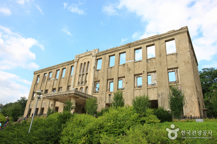
Cheorwon Korean Workers' Party Headquarters (철원 노동당사)
9.1 Km 25737 2023-03-07
265, Geumgangsan-ro, Cheorwon-gun, Gangwon-do
+82-33-450-5558
This three-story building located in Cheorwon-eup was constructed in 1946. Used as the headquarters of the Labor Party until the break of the Korean War on June 25, it is now a tourist attraction that still holds onto the vestiges of the Korean War.
Cheorwon Korean Workers' Party Headquarters is under the control of Cheorwon-gun Office as part of the Security Tour Course. Hundreds of thousands of people visit this tourist destination every year.
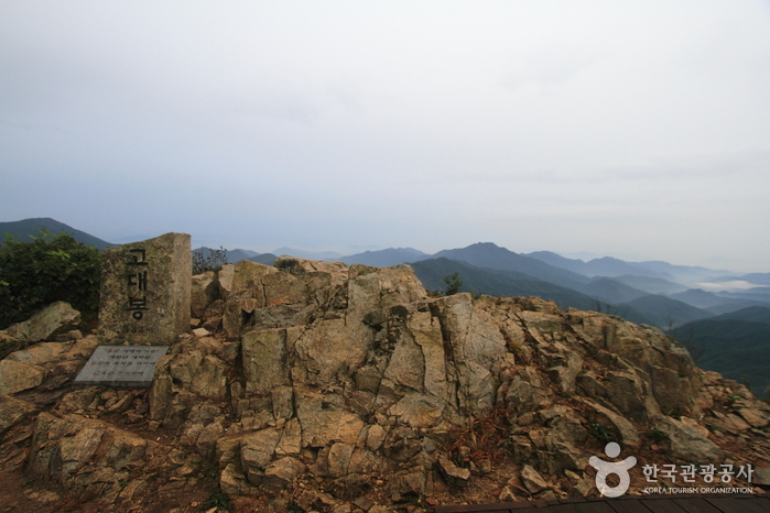
Godaesan Mountain (고대산)
11.2 Km 54539 2021-07-20
Sinseo-myeon, Yeoncheon-gun, Gyeonggi-do
+82-31-839-2061
Godaesan Mountain (alt. 832 meters) is located next to Sintan-ri Station, which is the railroad disconnection point of the Gyeongwon Line. It is also on the way to Geumgangsan Mountain. Godaesan is ideal for mountain hiking because of its natural beauty and well-preserved
ecosystem. Moreover, this is the only mountain in South Korea on which the North Korean territory can be seen.
There are several theories about the origin of the mountain's name. One is that the mountain had been referred to as "keungore" (big whale) in the past by local residents. Another is that the mountain looks like the
banggorae (smoke duct) of a traditional Korean heating system when seen from the Sintan area; this is because the mountain's deep valleys resemble the furrows under that house that facilitate the passage of hot air to heat the room above. On a topographic map, the mountain was also marked as "Gotae" (like the constellations high above).
Godaesan also has a dense forest, making it a suitable source of timber and charcoal. Because of its abundant forest resources, a jumak (a tavern or inn that served food and liquor and provided lodging to travelers) village was formed here. The place was well-known for
charcoal production prior to the Korean War.
On November 4, 1907, 150 soldiers from the Korean militia fought a fierce battle with the 8th Company of the Japanese Army's 20th Infantry Regiment in Yeoncheon. After the fight, the Korean militia were scattered throughout the jumak village. Later on, 60 of them engaged in a
fierce battle again with the Japanese soldiers on Godaesan. This is a place imbued with the brave spirit of the Korean people.
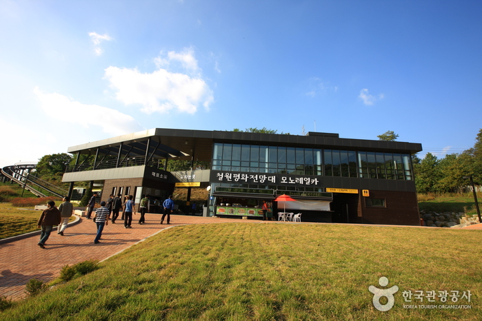
Cheorwon Peace Observatory (철원평화전망대)
12.3 Km 29724 2022-10-25
588-14, Junggang-ri, Cheorwon-gun, Gangwon-do
+82-33-450-5558
Cheorwon Peace Observatory offers a panoramic view of the DMZ (Demilitarized Zone separating North and South Korea) in the central forward area of Cheorwon-gun, Gangwon-do. From this observatory, one can see the Cheorwon plain, areas of the DMZ, and even North Korea. Photos of the 2nd Tunnel, military barracks, checkpoints, and the DMZ are exhibited here. Visitors can easily get to the observatory using the 50-person monorail, see the remains of the ancient Taebongguk (nation), and even see the faces of North Korean soldiers through binoculars.
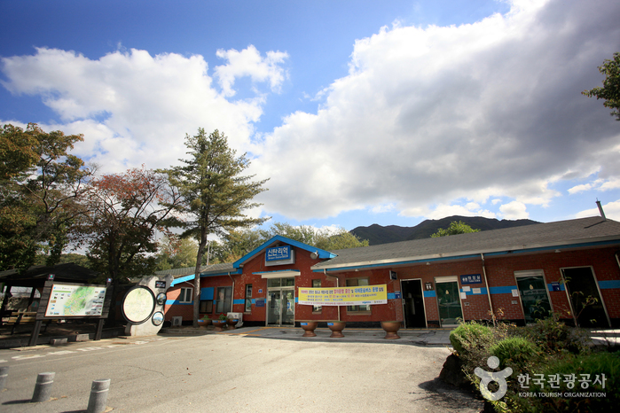
Sintan-ri Station (신탄리역)
12.4 Km 382 2021-08-18
4, Godaesan-gil, Yeoncheon-gun, Gyeonggi-do
+82-1544-7788
Sintan-ri Station, located on the Gyeongwon Line between Daegwang-ri and Baengmagoji Stations, opened on July 10, 1913. It was part of North Korean land after 1945, but was returned to South Korea in 1951. A sign labeling the station as the final station on the line was installed in 1971. With the opening of Baengmagoji Station on November 20, 2012, the station lost its title as the last station. However, many people still consider it as such, with many visitors coming to see the old sign.

Cheorwon Plain (Migratory Bird Habitat) (철원평야(철새도래지))
12.5 Km 12708 2021-11-29
Cheorwon-eup, Cheorwon-gun, Gangwon-do
+82-33-450-5558
After the fall harvest season, the fields of Cheorwon Plain are littered with fallen grains, providing an abundant source of food for migratory birds. Moreover, the well-preserved ecosystem of the Demilitarized Zone provides clean water and a healthy habitat, making the Cheorwon area a paradise for migratory birds.
Cranes stalking around the fields and birds taking off en masse from the reservoir make bird watchers exclaim in awe. In Cheorwon, which boasts the biggest white-fronted goose population in Korea, visitors can see observe 110 species of birds, some of which are protected as national treasures. Examples include red-crowned cranes, vultures, white-tailed sea eagles, and golden eagles as well as mallards and spot-billed ducks, which migrate to Korea for the winter.
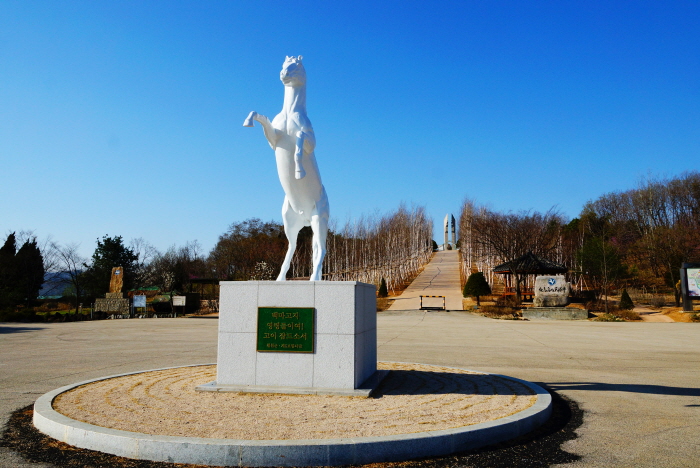
Memorial Tower of Baengmagoji Battlefield and Memorial Museum (백마고지 위령비와 기념관)
12.6 Km 25836 2020-05-27
72, Daema 1-gil, Cheorwon-gun, Gangwon-do
+82-33-450-5559
Located in the northern area of South Korea, Baengmagoji Battlefield was one of the bloodiest battlefields during the Korean War. The communist Chinese army launched a major offensive attack for 10 days on October 6, 1952 during the Battle of Baengmagoji, which can be translated into the Battle of White Horse Highlands. Due to this battle, the communist Chinese army suffered around 14,000 casualties and the army completely collapsed while the 9th Infantry Division won the Battle of Baengmagoji and got the nickname “White Horse.”
After the battle, the area gave off a bad smell because of the dead bodies. The mountain area lost its original shape due to the severe battle and as a result the area was named “Baengmagoji” as it was said to resemble a white horse (baengma) lying down.
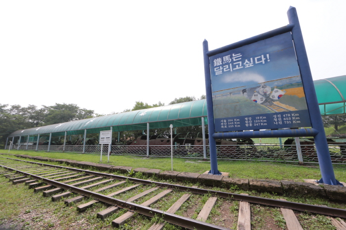
Woljeong-ri Station (월정리역)
12.8 Km 20407 2019-09-26
1882, Durumi-ro, Cheorwon-gun, Gangwon-do
+82-33-450-5559
Woljeong-ri Station (Iron Triangle Battlefield) is the last stop before reaching the DMZ. With the sign "The iron horse wants to run again," there stand remains of a train that was used to make frequent trips to North Korea. Located at the spot where the fiercest battle was held during the Korean War, this train marks the partition line of the Korean peninsula. These days Woljeong-ri Station is under the control of the Cheorwon-gun Office and hundreds of thousands of people visit this unique tourist area every year.
 English
 한국어
한국어 日本語
日本語 中文(简体)
 Deutsch
 Français
 Español
 Русский