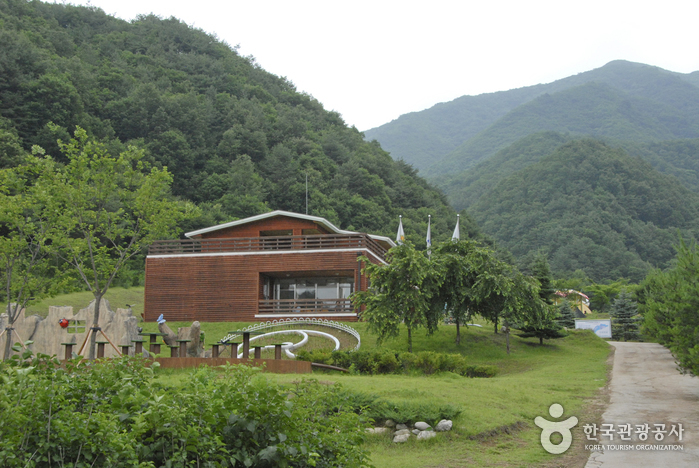
Yanggu Eco-Botanical Garden (양구생태식물원)
0m 25502 2022-08-18
169, Sumgol-ro 310beon-gil, Yanggu-gun, Gangwon-do
+82-33-480-7391
First opened in June 2004, Yanggu Eco-Botanical Garden was built on a total area of 189,141 ㎡. Nearly 3.1 billion Korean won (approximately 3 million USD) was spent on the construction and it was built to be developed into a South and North Korean ecosystem restoration center. Located in the northernmost region of South Korea, it houses more than 400 rare plants including plants that are Korean native species and protected by Korean Ministry of Environment.
The garden is divided into six parts by their features including a botanical garden, natural forest, and facilities zone. In the botanical garden, rare plants such as northern native plants and alpine plants that are naturally grown in the demilitarized zone (DMZ) and Yanggu area are displayed in one place.
There are also walking trails, a medicinal plants exhibition hall, plant nursery, and greenhouse. To add a natural and lively touch to the garden, a mountain stream zone and wetlands zone were prepared to provide people with the chance to enjoy the pleasant sound of running water.
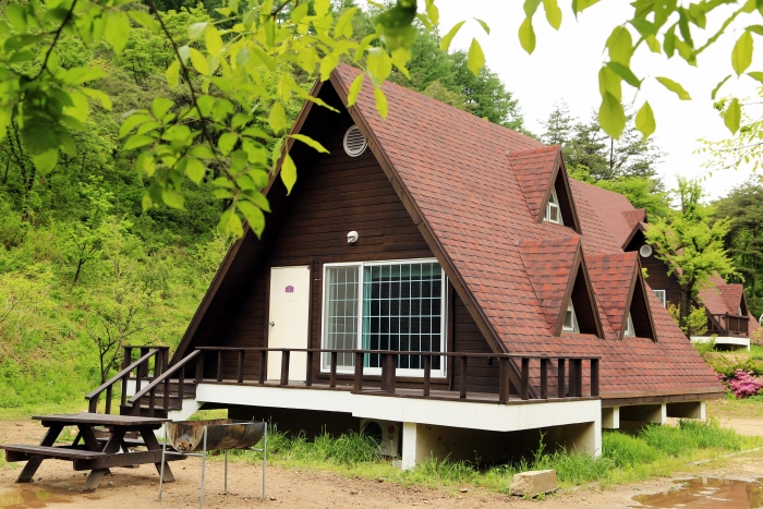
Gwangchi Recreational Forest (광치자연휴양림)
5.4 Km 25824 2021-03-25
265, Gwangchiryeong-ro 1794beon-gil, Yanggu-gun, Gangwon-do
+82-33-482-3115
Gwangchi Recreational Forest is located near Gwangchiryeong Pass (alt. 800 meters). The pass encompasses waterfalls and valleys in a dense forest. Gwangchi Tunnel connects the areas of Yanggu and Inje to the East Sea, making the forest a great addition to travel itineraries. The recreational area serves as a retreat for residents and helps to support the local economy through tourism.

Yongneup Marsh of Daeamsan Mountain (Gangwon Peace Area National Geopark) (대암산 용늪 (강원평화지역 국가지질공원))
7.4 Km 25048 2024-02-22
1106-27 Geumgang-ro, Seohwa-myeon, Inje-gun, Gangwon-do
Daeamsan Mountain is a rugged peak composed of rocks, reaching an altitude of 1,304 meters from the foothills to the summit. Formed in the hilly area on the southwest slope, Yongneup Marsh harbors both northern and southern plant species, housing various rare flora and fauna amidst its exceptional natural landscape. Exploring the ecology of Yongneup Marsh is possible through guided tours, including the Seoheung-ri course (three times a day, five hours) and the Gaa-ri course (once a day, three hours). Identification is required, and reservations are mandatory, with the presence of guides accompanying visitors.
Gachilbong Battlefield (가칠봉지구전투전적지)
8.5 Km 28951 2020-04-02
Haean-myeon, Yanggu-gun, Gangwon-do
+82-33-480-2675
The entire
town of Haean-myeon is contained in Haean Basin. Also known as Punch Bowl, Haean
Basin is surrounded by high peaks and one of these peaks is Gachilbong.
The
nature of the terrain in the Gachilbong area made it difficult to conduct
military operations during the Korean War. The North Korean military utilized these natural features to build a solid defense position and launch counterattacks, while the
South Korean soldiers in the lowland were in a disadvantageous position. South Korean soldiers were under the command of 5th
Division Commander Brigadier General Min Gi-sik and 24th Regiment Commander
Colonel Yu Ui-jun. On the North Korean side, the 7th, 14th, and 32nd Regiments of the
27th Division and the 23rd Regiment of the 12th Division under the 2nd Corps fought back.
By
sending a military deployment and conducting search operations, the
South Korean military completed a reconnaissance of the area on August 30 and
advanced to counterattack. On August 31, after defending their position for two
days, the South Korean soldiers were able to break the North Korean resistance.
Each unit secured a strongly fortified position to draw the North Korean
soldiers out. Thereafter, South Korea launched an all-out attack and captured Hill
1241. However, North Korea attacked again and South Korea retreated. After several attacks and counterattacks,
South Korea was able to take back Gachilbong and the surrounding areas. Although
it resulted in heavy casualties on both sides, this battle ultimately
gave South Korea possession of Haean Basin.
![Dutayeon Valley [National Geopark] (두타연 (강원평화지역 국가지질공원))](http://tong.visitkorea.or.kr/cms/resource/12/2668212_image2_1.jpg)
Dutayeon Valley [National Geopark] (두타연 (강원평화지역 국가지질공원))
10.4 Km 14149 2021-07-17
Gobangsan-ri, Yanggu-gun, Gangwon-do
+82-33-480-2251
Dutayeon Valley is located north of the Civilian Control Line, requiring advance reservation through the Yanggu-gun Office website as well as filling out admission information at the Dutayeon Gallery before entering the area with a guide. The valley has a waterfall located along Sataecheon Stream where it merges with Suipcheon Stream. The water falls into a plunge pool, which has also carved out a deep cave in the bedrock at the base of the waterfall.
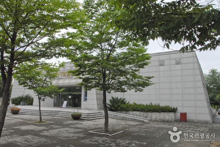
Yanggu Prehistory Museum (양구선사박물관)
10.8 Km 26046 2022-08-18
439-52, Geumgangsan-ro, Yanggu-gun, Gangwon-do
+82-33-480-7220
Yanggu Prehistory Museum displays artifacts from the Paleolithic Age found in Sangmuryong-ri, Yanggu-eup and the Neolith Age discovered in Hyeon-ri, Haean-myeon. It is the first prehistory museum in the nation and aims to teach visitors about Korean prehistoric culture in a manner easy to understand.
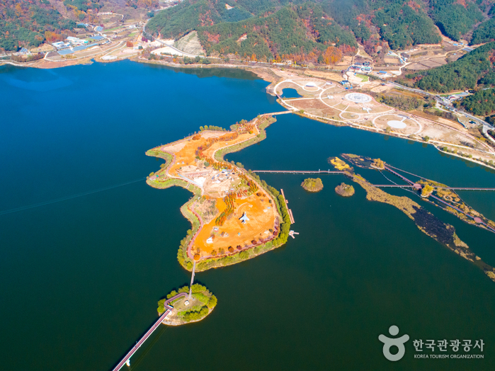
Paroho Lake (Yanggu) (파로호(양구))
10.9 Km 20844 2021-11-30
545, Ha-ri, Yanggu-gun, Gangwon-do
+82-33-480-2531
Paroho Lake is a manmade lake that was completed in 1943. The lake was created due to the construction of a hydraulic power plant in Hwacheon during Japanese colonial period. The name was given after President Syngman Rhee designated a plaque in his own handwriting naming the body of water ‘Paroho Lake’ during the Korean War after a victorious feat in a battle against the Chinese army. The power plant has a generation capacity of 105,000 kilowatts, and the lake is one of the top fishing grounds in Korea as it is abundant in freshwater fish.
The area boasts several splendid views and a former president built his country home on the lake. Relics from the Stone Age and New Stone Age were found to be well preserved in the area. Twenty-one dolmens were found on the lake grounds, as well as 4,000 pieces of Prehistoric relics used during Paleolithic age, drawing interest from the academic field. Recently, habitats of mandarin ducks, a national natural monument, were found near the Paroho lakeside.
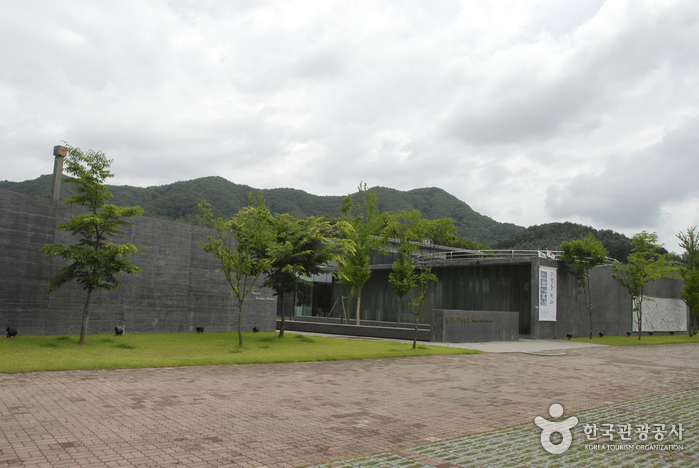
Yanggu Porcelain Museum (양구백자박물관)
11.2 Km 19976 2022-08-09
5182, Pyeonghwa-ro, Yanggu-gun, Gangwon-do
+82-33-480-7237
Yanggu Porcelain Museum (formerly Bangsan Porcelain Museum) exhibits white porcelain from the Bangsan area, along with its collection and tools. There are also various visual aids that help understand the history of porcelain in the Bangsan area. The experience room is equipped with electric kilns, gas kilns, and firewood kilns, and is a facility for both outdoor and indoor experiences. Here, visitors can experience the entire process of making clay, molding, and baking it in a kiln. Bangsan-myeon, Yanggu was already well-known for pottery production since the Goryeo dynasty. During the Joseon dynasty, raw materials were supplied to the Gwangju branch in Gyeonggi-do, and here the technology and aesthetics spread to Gwangju.
Yanggu Punch Bowl Village (양구 펀치볼마을 (펀치볼))
12.4 Km 22334 2020-08-31
50-3, Dongmakdong-gil, Yanggu-gun, Gangwon-do
+82-33-481-2648
Punch Bowl is a highland basin situated 400-500 meters above sea level in Yanggu-gun, Gangwon-do. The name comes from the basin's resemblance to a large punch bowl. The village has around 1,700 residents, and is the only town that is located inside the Civilian Access Control Line. Along with the nearby Daeamsan Mountain, Punch Bowl was once a ferocious battlefield during the Korean War. Several monuments were erected in memory of the deceased souls. Since the war, civilian access has been limited, allowing the natural environment in the area to recover. Rare flora and fauna reside in the area, and on top of Daeamsan Mountain is Yongneup Swamp (Natural Monument No. 246), Korea's one and only high moor and time-honored treasure trove for the ecosystem.
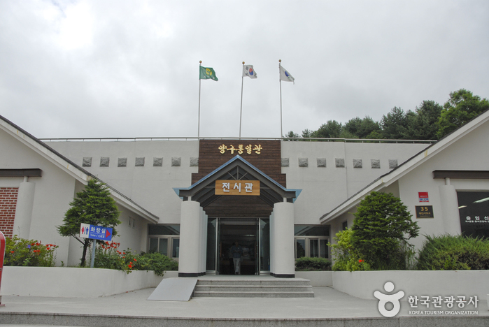
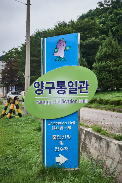
Yanggu Unification Hall (양구통일관)
12.5 Km 27437 2021-09-10
35, Haeanseohwa-ro, Yanggu-gun, Gangwon-do
+82-33-481-9021
The Yanggu Unification Hall is located in the northernmost part of the Civilian Control Zone in Haean-myeon, Yanggu-gun. It was built and opened to be utilized as a unification education center that would help broaden people’s understanding about the real situation in North Korea in preparation for reunification and encourage commitment for reunification. The location is 5 kilometers away from The 4th Tunnel, in the northern end of the punch bowl basin and it first opened in 1996. It has a first exhibition hall, second exhibition hall, agricultural specialty market, and a parking lot that can accommodate about 100 vehicles.
Directly operated by Yanggu-gun District Office, the Yanggu Unification Hall displays materials that show the reality of North Korea including household goods, exports and photographs. The agricultural specialty market sells agricultural goods, North Korean products, and tourism souvenirs. Located nearby are The 4th Tunnel, Eulji Observatory, and War Memorial Museum in Yanggu. Eulji Observatory is the northernmost located observatory in South Korea. The 4th Tunnel is the only tunnel among the four tunnels dug by North Korea that operates electric cars, allowing visitors to travel inside. The War Memorial Museum in Yanggu was built to shed new light on the nine battles fought in Yanggu during the Korean War. The Yanggu Unification Hall deals with works related to the Eulji Observatory, The 4th Tunnel and War Memorial Museum in Yanggu.
 English
 한국어
한국어 日本語
日本語 中文(简体)
 Deutsch
 Français
 Español
 Русский